|
search place name
|
||
Weidenhain (Sachsen, Germany)Weidenhain is a town in the Sachsen region of Germany. An overview map of the region around Weidenhain is displayed below.
regional and 3d topo map of Weidenhain, Germany ::

Weidenhain airports ::
The nearest airport is LEJ - Leipzig Halle, located 44.8 km west of Weidenhain.
Other airports nearby include AOC - Altenburg Nobitz (69.3 km south), DRS - Dresden (80.1 km south east), SXF - Berlin Schonefeld (101.6 km north east), THF - Berlin Tempelhof (107.8 km north), Nearby towns ::
Großwig (2.3km east) //
Gräfendorf (3.9km south) //
Zietenhof (3.5km east) //
Roitzsch (5.1km north west) //
Trossin (6.0km north) //
Kommende Dommitzsch (6.0km north) //
Wildenhain (5.1km south west) //
Audenhain (7.4km south) //
Mahlitzsch (7.5km north) //
Niederaudenhain (7.5km south) //
Oberaudenhain (7.5km south) //
Klitzschen (6.5km south east) //
Meltitz (7.8km north) //
Leipnitz (8.2km north west) //
Mockrehna (8.2km south west) //
Gniebitz (7.2km north west) //
Vogelgesang (7.2km north east) //
Dahlenberg (8.7km north west) //
Drebligar (8.7km north east) //
[all distances 'as the bird flies' and approximate] 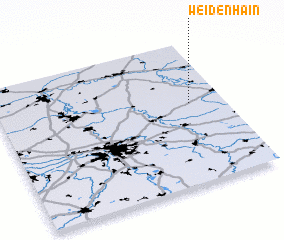 Places with similar names to Weidenhain, Germany ::
// Weidenhahn (DE)
Disclaimer :: Information on this page comes without warranty of any kind |
||
|
Where is Weidenhain? Elevation and coordinates ::
Latitude (lat): 51°34'0"N Longitude (lon): 12°51'0"E
Elevation (approx.): 106m (map arrows pan, magnifying glasses zoom) |
||
|
Visiting Weidenhain? Hotel/Accommodation ::
Book a hotel in Weidenhain Travel Guide ::
Buy a travel guide for Germany rental cars ::
car rental offers GPS waypoint ::
download a GPX waypoint (PoI) of Weidenhain for your GPS receiver
|
||