|
search place name
|
||
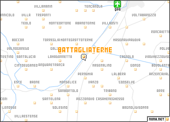
Battaglia Terme (Italy)Battaglia Terme is a town in Italy. An overview map of the region around Battaglia Terme is displayed below.
regional and 3d topo map of Battaglia Terme, Italy ::
Battaglia Terme airports ::
The nearest airport is QPA - Padova, located 13.5 km north of Battaglia Terme.
Other airports nearby include VIC - Vicenza (37.9 km north west), VCE - Venice Venezia Tessera (50.9 km north east), TSF - Treviso (51.8 km north east), VRN - Villafranca (71.2 km west), Nearby towns ::
Mezzavia (2.3km north east) //
Pernumia (3.7km south) //
Carrara San Giorgio (2.6km east) //
Montegrotto Terme (3.9km north) //
Maseralino (3.2km south east) //
La Madonnetta (3.9km west) //
Cornegliana (4.3km north east) //
Galzignano (4.3km north west) //
Vanzo (5.7km south) //
Monselice (6.1km south west) //
San Pietro Viminario (6.1km south east) //
Abano Terme (7.4km north) //
Arqua Petrarca (5.5km west) //
San Bortolo (7.9km south) //
Torreglia (6.4km north west) //
LʼAlbera (6.4km south east) //
Tribano (8.4km south east) //
Villa Osti (8.4km north east) //
Monte Ortone (8.4km north west) //
Marendole (9.1km south west) //
[all distances 'as the bird flies' and approximate]  Places with similar names to Battaglia Terme, Italy :: Disclaimer :: Information on this page comes without warranty of any kind |
||
|
Where is Battaglia Terme? Elevation and coordinates ::
Latitude (lat): 45°17'0"N Longitude (lon): 11°47'0"E
Elevation (approx.): 4m (map arrows pan, magnifying glasses zoom) |
||
|
Visiting Battaglia Terme? Hotel/Accommodation ::
Book a hotel in Battaglia Terme Travel Guide ::
Buy a travel guide for Italy rental cars ::
car rental offers GPS waypoint ::
download a GPX waypoint (PoI) of Battaglia Terme for your GPS receiver
|
||