|
search place name
|
||
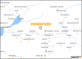
Poira di Fuori (Italy)Poira di Fuori is a town in Italy. An overview map of the region around Poira di Fuori is displayed below.
regional and 3d topo map of Poira di Fuori, Italy ::
Poira di Fuori airports ::
The nearest airport is SMV - Samedan, located 49.0 km north east of Poira di Fuori.
Other airports nearby include LUG - Lugano (51.4 km west), BGY - Bergamo Orio Al Serio (56.4 km south), LIN - Milan Linate (82.6 km south), MXP - Milano Malpensa (86.3 km south west), Nearby towns ::
Poira di Dentro (1.3km east) //
Traona (2.3km south west) //
Mello (2.3km south east) //
Cercino (3.2km south west) //
Prato Gudo (3.2km south east) //
Morbegno (4.5km south east) //
Sacco (5.7km south) //
Frasnedo (5.3km north west) //
Campiano (6.1km south east) //
Rogolo (5.3km south west) //
Rasura (7.5km south) //
Dazio (5.5km east) //
La Masonaccia (6.8km south west) //
Ronchi (7.8km south) //
Albaredo per San Marco (8.4km south east) //
[all distances 'as the bird flies' and approximate] 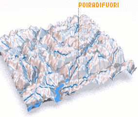 Places with similar names to Poira di Fuori, Italy ::
// Pôrto Faria (BR)
// Pôrto Ferrão (BR)
// Puerto Frío (PA)
// Porto Fuori (IT)
// Pradovera (IT)
// Praia da Vieira (PT)
// Port Ivory (US)
// Puerto Ferry (PE)
// Portoferraio (IT)
// Preddvor (SI)
Disclaimer :: Information on this page comes without warranty of any kind |
||
|
Where is Poira di Fuori? Elevation and coordinates ::
Latitude (lat): 46°10'0"N Longitude (lon): 9°32'0"E
Elevation (approx.): 996m (map arrows pan, magnifying glasses zoom) |
||
|
Visiting Poira di Fuori? Hotel/Accommodation ::
Book a hotel in Poira di Fuori Travel Guide ::
Buy a travel guide for Italy rental cars ::
car rental offers GPS waypoint ::
download a GPX waypoint (PoI) of Poira di Fuori for your GPS receiver
|
||