|
search place name
|
||
San Cassiano di Livenza (Veneto, Italy)San Cassiano di Livenza is a town in the Veneto region of Italy. An overview map of the region around San Cassiano di Livenza is displayed below.
regional and 3d topo map of San Cassiano di Livenza, Italy ::

San Cassiano di Livenza airports ::
The nearest airport is AVB - Aviano Ab (Pagliano E Gori), located 19.3 km north of San Cassiano di Livenza.
Other airports nearby include TSF - Treviso (34.7 km south west), VCE - Venice Venezia Tessera (42.2 km south), QPA - Padova (73.7 km south west), TRS - Ronchi De Legionari Ronchi Dei Legionari (74.8 km east), Nearby towns ::
Portobuffolè (2.2km south east) //
Gaiarine (2.5km north west) //
Brugnera (4.2km north) //
Mansuè (5.2km south) //
Maron (4.9km north east) //
Cavolano (7.2km north) //
Fontanelle (5.8km south west) //
Casa Marcantonio (7.9km south) //
Cornizzai (5.9km east) //
Palazzo Del Maino (6.3km west) //
Codognè (6.2km west) //
Bibano (6.8km north west) //
Bibano di Sotto (6.9km north west) //
Tamai (8.0km north east) //
Casa Prosdocimi (8.1km south east) //
[all distances 'as the bird flies' and approximate] 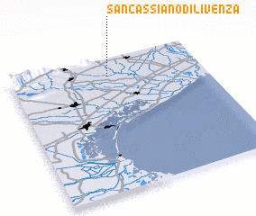 Places with similar names to San Cassiano di Livenza, Italy :: Disclaimer :: Information on this page comes without warranty of any kind |
||
|
Where is San Cassiano di Livenza? Elevation and coordinates ::
Latitude (lat): 45°52'7"N Longitude (lon): 12°30'38"E
Elevation (approx.): 10m (map arrows pan, magnifying glasses zoom) |
||
|
Visiting San Cassiano di Livenza? Hotel/Accommodation ::
Book a hotel in San Cassiano di Livenza Travel Guide ::
Buy a travel guide for Italy rental cars ::
car rental offers GPS waypoint ::
download a GPX waypoint (PoI) of San Cassiano di Livenza for your GPS receiver
|
||