|
search place name
|
||
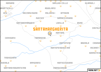
Santa Margherita (Italy)Santa Margherita is a town in Italy. An overview map of the region around Santa Margherita is displayed below.
regional and 3d topo map of Santa Margherita, Italy ::
Santa Margherita airports ::
The nearest airport is PEG - Perugia, located 80.9 km south west of Santa Margherita.
Other airports nearby include RMI - Rimini (88.8 km north west), PSR - Pescara (130.5 km south east), FRL - Forli (134.2 km north west), PUY - Pula (166.1 km north), Nearby towns ::
Centofinestre (1.9km south) //
Montoro (2.7km east) //
Tornasano (3.3km south west) //
Filottrano (3.3km south west) //
La Villa (4.6km north east) //
Contrada i Monti (5.5km north west) //
Rustico (6.2km north west) //
Montefano (5.5km south east) //
Montefano Vecchio (6.2km south east) //
Polverigi (7.4km north) //
San Paterniano (6.9km north east) //
Offagna (8.4km north east) //
Mazzangrugno (9.2km north west) //
[all distances 'as the bird flies' and approximate] 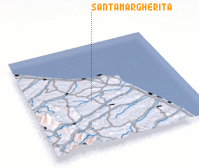 Places with similar names to Santa Margherita, Italy ::
// Santa Margherita (IT)
// Santa Margherita (IT)
// Santa Margherita (IT)
// Santa Margherita (IT)
// Santa Margherita (IT)
Disclaimer :: Information on this page comes without warranty of any kind |
||
|
Where is Santa Margherita? Elevation and coordinates ::
Latitude (lat): 43°27'0"N Longitude (lon): 13°23'0"E
Elevation (approx.): 184m (map arrows pan, magnifying glasses zoom) |
||
|
Visiting Santa Margherita? Hotel/Accommodation ::
Book a hotel in Santa Margherita Travel Guide ::
Buy a travel guide for Italy rental cars ::
car rental offers GPS waypoint ::
download a GPX waypoint (PoI) of Santa Margherita for your GPS receiver
|
||