|
search place name
|
||
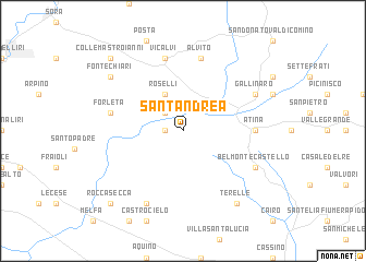
SantʼAndrea (Italy)SantʼAndrea is a town in Italy. An overview map of the region around SantʼAndrea is displayed below.
regional and 3d topo map of SantʼAndrea, Italy ::
SantʼAndrea airports ::
The nearest airport is QLT - Latina, located 69.2 km west of SantʼAndrea.
Other airports nearby include NAP - Naples Capodichino (93.6 km south east), CIA - Rome Ciampino (96.9 km west), PSR - Pescara (97.8 km north), FCO - Rome Fiumicino (125.1 km west), Nearby towns ::
Montattico (1.4km west) //
Casalattico (1.4km west) //
Casalvieri (2.3km north west) //
Roselli (4.0km north) //
Atina (5.5km east) //
Vicalvi (7.5km north) //
Forleta (5.8km west) //
Alvito (7.5km north) //
Gallinaro (6.7km north east) //
Colle San Magno (7.9km south) //
Belmonte Castello (6.7km south east) //
Fontechiari (7.8km north west) //
Terelle (8.5km south east) //
Colle Mastroianni (9.3km north west) //
Roccasecca (9.3km south west) //
[all distances 'as the bird flies' and approximate] 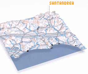 Places with similar names to SantʼAndrea, Italy ::
// Santana do Ouro (BR)
// Santo André (BR)
// Santo André (BR)
// Santo André (BR)
// Santo André (BR)
// Santo André (BR)
// Santo André (BR)
// Santo André (BR)
// Santo André (BR)
// Saint Andrew (US)
Disclaimer :: Information on this page comes without warranty of any kind |
||
|
Where is SantʼAndrea? Elevation and coordinates ::
Latitude (lat): 41°37'0"N Longitude (lon): 13°44'0"E
Elevation (approx.): 511m (map arrows pan, magnifying glasses zoom) |
||
|
Visiting SantʼAndrea? Hotel/Accommodation ::
Book a hotel in SantʼAndrea Travel Guide ::
Buy a travel guide for Italy rental cars ::
car rental offers GPS waypoint ::
download a GPX waypoint (PoI) of SantʼAndrea for your GPS receiver
|
||