|
search place name
|
||
SantʼAndrea (Friuli-Venezia Giulia, Italy)SantʼAndrea is a town in the Friuli-Venezia Giulia region of Italy. An overview map of the region around SantʼAndrea is displayed below.
regional and 3d topo map of SantʼAndrea, Italy ::

SantʼAndrea airports ::
The nearest airport is TRS - Ronchi De Legionari Ronchi Dei Legionari, located 14.6 km south west of SantʼAndrea.
Other airports nearby include POW - Portoroz (50.1 km south), LJU - Ljubliana Ljubljana (74.3 km north east), AVB - Aviano Ab (Pagliano E Gori) (78.6 km west), KLU - Klagenfurt (Worthersee Intl) (98.1 km north east), Nearby towns ::
Gorizia (2.3km north) //
Lucinico (2.2km north west) //
Miren (3.3km south) //
Savogna dʼIsonzo (3.0km south west) //
Peci (3.5km south) //
Rupa (3.7km south) //
Vrtojba (3.0km south east) //
Orehovlje (4.1km south) //
Piuma (4.4km north) //
Gábria (4.4km south) //
Šempeter pri Gorici (3.3km east) //
Rožna Dolina (3.6km north east) //
Bilje (4.2km south east) //
Vrtoče (4.8km south) //
Pristava (4.2km north east) //
Oslávia (5.3km north) //
Mossa (4.3km north west) //
Nova Gorica (5.4km north east) //
San Floriano del Cóllio (6.5km north) //
Devetachi (6.4km south) //
San Máuro (6.5km north east) //
Lokvica (7.1km south) //
Podsabotin (7.3km north) //
Villanova di Farra (5.3km west) //
Visintini (7.1km south) //
Gornje Cerovo (7.1km north west) //
Solkan (6.6km north east) //
Hum (7.8km north) //
Dolnje Cerovo (7.0km north west) //
[all distances 'as the bird flies' and approximate] 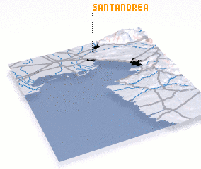 Places with similar names to SantʼAndrea, Italy ::
// Santana do Ouro (BR)
// Santo André (BR)
// Santo André (BR)
// Santo André (BR)
// Santo André (BR)
// Santo André (BR)
// Santo André (BR)
// Santo André (BR)
// Santo André (BR)
// Saint Andrew (US)
Disclaimer :: Information on this page comes without warranty of any kind |
||
|
Where is SantʼAndrea? Elevation and coordinates ::
Latitude (lat): 45°55'27"N Longitude (lon): 13°35'55"E
Elevation (approx.): 59m (map arrows pan, magnifying glasses zoom) |
||
|
Visiting SantʼAndrea? Hotel/Accommodation ::
Book a hotel in SantʼAndrea Travel Guide ::
Buy a travel guide for Italy rental cars ::
car rental offers GPS waypoint ::
download a GPX waypoint (PoI) of SantʼAndrea for your GPS receiver
|
||