|
search place name
|
||
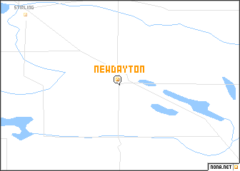
New Dayton (Alberta, Canada)New Dayton is a town in the Alberta region of Canada. An overview map of the region around New Dayton is displayed below.
regional and 3d topo map of New Dayton, Canada ::
New Dayton airports ::
The nearest airport is YQL - Lethbridge, located 38.4 km north west of New Dayton.
Other airports nearby include CTB - Cutbank Cut Bank Muni (89.9 km south), YXH - Medicine Hat (137.3 km north east), YYC - Calgary Intl (221.9 km north west), GTF - Great Falls Intl (227.8 km south), Nearby towns ::
[all distances 'as the bird flies' and approximate]  Places with similar names to New Dayton, Canada ::
// Notodden (NO)
// New Taiton (US)
// Ndidiène (SN)
// Nto Edino (NG)
// Not'ot'an (KP)
// Ndiawdoun (SN)
// Notudden (SE)
// Niutoudian (CN)
Disclaimer :: Information on this page comes without warranty of any kind |
||
|
Where is New Dayton? Elevation and coordinates ::
Latitude (lat): 49°25'0"N Longitude (lon): 112°23'0"W
Elevation (approx.): 982m (map arrows pan, magnifying glasses zoom) |
||
|
Visiting New Dayton? Hotel/Accommodation ::
Book a hotel in New Dayton Travel Guide ::
Buy a travel guide for Canada rental cars ::
car rental offers GPS waypoint ::
download a GPX waypoint (PoI) of New Dayton for your GPS receiver
|
||