|
search place name
|
||
Krpeľany (Slovakia)Krpeľany is a town in Slovakia. An overview map of the region around Krpeľany is displayed below.
regional and 3d topo map of Krpeľany, Slovakia ::

Krpeľany airports ::
The nearest airport is SLD - Sliac, located 55.2 km south of Krpeľany.
Other airports nearby include TAT - Poprad Tatry (84.8 km east), OSR - Ostrava Mosnov (94.3 km north west), PZY - Piestany (108.0 km south west), KRK - Krakow Balice (116.6 km north east), Nearby towns ::
Ratkovo (0.0km north) //
Nolčovo (1.9km south) //
Šútovo (1.9km north) //
Turany (3.1km south west) //
Konské (3.9km south) //
Kraľovany (4.1km north east) //
Podhradie (6.1km south west) //
Štiavnička (7.4km south west) //
Salatín (8.9km south east) //
[all distances 'as the bird flies' and approximate] 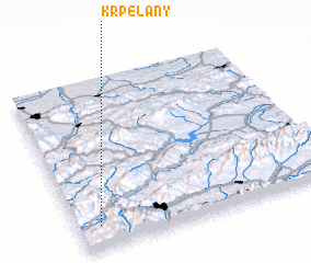 Places with similar names to Krpeľany, Slovakia ::
// Kräpelin (DE)
// Kröpelin (DE)
// Kruplin (PL)
// Krepliņi (LV)
// Khryplin (UA)
// Carapilana (PE)
// Cara Plaine (HT)
// Craplain (HT)
// Kirpāliān (PK)
Disclaimer :: Information on this page comes without warranty of any kind |
||
|
Where is Krpeľany? Elevation and coordinates ::
Latitude (lat): 49°8'0"N Longitude (lon): 19°5'0"E
Elevation (approx.): 439m (map arrows pan, magnifying glasses zoom) |
||
|
Visiting Krpeľany? Hotel/Accommodation ::
Book a hotel in Krpeľany Travel Guide ::
Buy a travel guide for Slovakia rental cars ::
car rental offers GPS waypoint ::
download a GPX waypoint (PoI) of Krpeľany for your GPS receiver
|
||