|
search place name
|
||
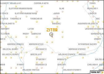
Žitná (Slovakia)Žitná is a town in Slovakia. An overview map of the region around Žitná is displayed below.
regional and 3d topo map of Žitná, Slovakia ::
Žitná airports ::
The nearest airport is PZY - Piestany, located 41.5 km west of Žitná.
Other airports nearby include SLD - Sliac (59.5 km east), PRV - Prerov (100.7 km north west), OSR - Ostrava Mosnov (104.8 km north), BTS - Bratislava M R Stefanik (107.1 km south west), Nearby towns ::
Radiša (0.0km north) //
Striebornica (1.9km south) //
Uhrovec (2.2km south west) //
Uhrovské Podhradie (2.4km east) //
Omastiná (3.1km north east) //
Rakovec (3.9km north) //
Kšinná (5.6km north) //
Dubnička (3.7km west) //
Látkovce (5.6km south) //
Stavanie (5.7km north) //
Závada (5.7km north) //
Miezgovce (6.1km south west) //
Horné Naštice (5.2km south west) //
Jurka (7.5km north) //
ľutov (5.2km west) //
Trebichava (6.7km north west) //
Dolné Vestenice (8.3km south east) //
Brezolupy (8.3km south west) //
[all distances 'as the bird flies' and approximate] 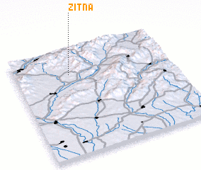 Places with similar names to Žitná, Slovakia ::
Disclaimer :: Information on this page comes without warranty of any kind |
||
|
Where is Žitná? Elevation and coordinates ::
Latitude (lat): 48°46'0"N Longitude (lon): 18°21'0"E
Elevation (approx.): 274m (map arrows pan, magnifying glasses zoom) |
||
|
Visiting Žitná? Hotel/Accommodation ::
Book a hotel in Žitná Travel Guide ::
Buy a travel guide for Slovakia rental cars ::
car rental offers GPS waypoint ::
download a GPX waypoint (PoI) of Žitná for your GPS receiver
|
||