|
search place name
|
||
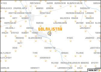
Dolní Líštná (Czech Republic)Dolní Líštná is a town in Czech Republic. An overview map of the region around Dolní Líštná is displayed below.
regional and 3d topo map of Dolní Líštná, Czech Republic ::
Dolní Líštná airports ::
The nearest airport is OSR - Ostrava Mosnov, located 42.5 km west of Dolní Líštná.
Other airports nearby include KRK - Krakow Balice (89.5 km north east), KTW - Katowice Pyrzowice (92.1 km north), PRV - Prerov (98.0 km west), SLD - Sliac (120.5 km south), Nearby towns ::
Vendryně (1.9km south) //
Kojkovice (1.9km north) //
Lyžbice (2.2km south west) //
Horní Líštná (2.2km north east) //
Puńców (4.4km north west) //
Leszna Górna (4.4km north east) //
Třinec (3.6km west) //
Karpentná (5.6km south) //
Oldřichovice (4.0km south west) //
Bażanowice (5.7km north) //
Dzięgielów (5.7km north) //
Bystřice (5.7km south) //
Nýdek (5.1km east) //
Mnisztowo (7.5km north) //
Konská (5.1km west) //
Goleszów (6.6km north east) //
Hrádek (8.2km south east) //
Tyra (8.2km south west) //
[all distances 'as the bird flies' and approximate]  Places with similar names to Dolní Líštná, Czech Republic :: Disclaimer :: Information on this page comes without warranty of any kind |
||
|
Where is Dolní Líštná? Elevation and coordinates ::
Latitude (lat): 49°41'0"N Longitude (lon): 18°42'0"E
Elevation (approx.): 402m (map arrows pan, magnifying glasses zoom) |
||
|
Visiting Dolní Líštná? Hotel/Accommodation ::
Book a hotel in Dolní Líštná Travel Guide ::
rental cars ::
car rental offers GPS waypoint ::
download a GPX waypoint (PoI) of Dolní Líštná for your GPS receiver
|
||