|
search place name
|
||
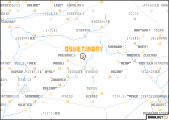
Osvětimany (Czech Republic)Osvětimany is a town in Czech Republic. An overview map of the region around Osvětimany is displayed below.
regional and 3d topo map of Osvětimany, Czech Republic ::
Osvětimany airports ::
The nearest airport is PRV - Prerov, located 41.5 km north of Osvětimany.
Other airports nearby include BRQ - Turany (41.6 km west), PZY - Piestany (64.9 km south east), OSR - Ostrava Mosnov (93.9 km north east), BTS - Bratislava M R Stefanik (99.7 km south), Nearby towns ::
Hostějov (1.9km south) //
Medlovice (2.2km south east) //
Vřesovice (2.4km west) //
Labuty (3.1km south west) //
Žeravice (3.9km south) //
Újezdec (3.9km south) //
Syrovín (3.9km south) //
Ježov (4.4km south west) //
Skalka (4.4km south west) //
Stupava (5.6km north) //
Podolí (4.1km south west) //
Ořechov (5.2km south east) //
Stříbrnice (4.9km east) //
Smradávka (5.2km east) //
Těmice (7.5km south) //
Žádovice (6.6km south west) //
Staré Hutě (7.8km north) //
Domanín (7.8km south) //
Hýsly (6.1km south west) //
Vážany (6.1km south east) //
Koryčany (7.4km north west) //
Lískovec (7.4km north west) //
Kelčany (8.9km south west) //
[all distances 'as the bird flies' and approximate]  Places with similar names to Osvětimany, Czech Republic :: Disclaimer :: Information on this page comes without warranty of any kind |
||
|
Where is Osvětimany? Elevation and coordinates ::
Latitude (lat): 49°4'0"N Longitude (lon): 17°15'0"E
Elevation (approx.): 330m (map arrows pan, magnifying glasses zoom) |
||
|
Visiting Osvětimany? Hotel/Accommodation ::
Book a hotel in Osvětimany Travel Guide ::
rental cars ::
car rental offers GPS waypoint ::
download a GPX waypoint (PoI) of Osvětimany for your GPS receiver
|
||