|
search place name
|
||
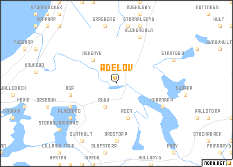
Adelöv (Jönköping, Sweden)Adelöv is a town in the Jönköping region of Sweden. An overview map of the region around Adelöv is displayed below.
regional and 3d topo map of Adelöv, Sweden ::
Adelöv airports ::
The nearest airport is JKG - Joenkoeping Jonkoping, located 46.9 km south west of Adelöv.
Other airports nearby include KVB - Skovde (62.3 km north west), LPI - Linkoeping Saab (72.6 km north east), HLF - Hultsfred (89.1 km south east), LDK - Lidkoping (100.0 km north west), Nearby towns ::
 Places with similar names to Adelöv, Sweden ::
// Adolfów (PL)
// Atolovo (BG)
// Adileva (RU)
// Adolfo (MX)
// Adolfo (MZ)
// Adelfia (IT)
// Adolfo (BR)
// Aḑ Ḑalfa‘ah (SA)
// Aït el Aïaf (MA)
// Aït Oualef (MA)
Disclaimer :: Information on this page comes without warranty of any kind |
||
|
Where is Adelöv? Elevation and coordinates ::
Latitude (lat): 58°2'0"N Longitude (lon): 14°40'0"E
Elevation (approx.): 189m (map arrows pan, magnifying glasses zoom) |
||
|
Visiting Adelöv? Hotel/Accommodation ::
Book a hotel in Adelöv Travel Guide ::
Buy a travel guide for Sweden rental cars ::
car rental offers GPS waypoint ::
download a GPX waypoint (PoI) of Adelöv for your GPS receiver
|
||