|
search place name
|
||
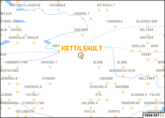
Kettilshult (Kalmar, Sweden)Kettilshult is a town in the Kalmar region of Sweden. An overview map of the region around Kettilshult is displayed below.
regional and 3d topo map of Kettilshult, Sweden ::
Kettilshult airports ::
The nearest airport is KLR - Kalkmar Kalmar, located 24.8 km north east of Kettilshult.
Other airports nearby include RNB - Ronneby (53.6 km south west), VXO - Vaxjo Kronoberg (86.8 km north west), OSK - Oskarshamn (94.8 km north), HLF - Hultsfred (109.0 km north), Nearby towns ::
Bossmåla (1.9km north) //
Idehult (1.9km north) //
Ålebo (2.8km south east) //
Runtorp (5.6km north) //
Karlshult (5.7km south) //
Påryd (3.6km north west) //
Bilsäng (3.6km north west) //
Vörehult (4.5km south west) //
Yggesbo (6.3km south east) //
Gissemåla (7.7km south) //
Prästlycke (6.9km south east) //
Strömby (6.9km south west) //
Tvärskog (8.5km north east) //
[all distances 'as the bird flies' and approximate] 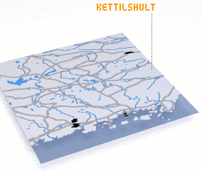 Places with similar names to Kettilshult, Sweden :: Disclaimer :: Information on this page comes without warranty of any kind |
||
|
Where is Kettilshult? Elevation and coordinates ::
Latitude (lat): 56°33'0"N Longitude (lon): 15°58'0"E
Elevation (approx.): 58m (map arrows pan, magnifying glasses zoom) |
||
|
Visiting Kettilshult? Hotel/Accommodation ::
Book a hotel in Kettilshult Travel Guide ::
Buy a travel guide for Sweden rental cars ::
car rental offers GPS waypoint ::
download a GPX waypoint (PoI) of Kettilshult for your GPS receiver
|
||