|
search place name
|
||
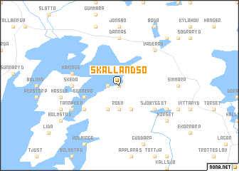
Skällandsö (Kronoberg, Sweden)Skällandsö is a town in the Kronoberg region of Sweden. An overview map of the region around Skällandsö is displayed below.
regional and 3d topo map of Skällandsö, Sweden ::
Skällandsö airports ::
The nearest airport is VXO - Vaxjo Kronoberg, located 55.0 km east of Skällandsö.
Other airports nearby include HAD - Halmstad (70.7 km south west), JKG - Joenkoeping Jonkoping (85.6 km north), GOT - Gothenborg Landvetter (119.2 km north west), RNB - Ronneby (119.9 km south east), Nearby towns ::
Lindhult (0.0km north) //
Jonsboda (1.0km west) //
Roen (3.7km south) //
Flahult (3.8km south) //
Hult (3.8km south) //
Sunnerö (3.6km south west) //
Färle (4.8km south west) //
Sjöbygget (4.8km south east) //
Skeda (4.0km west) //
Dannäs (7.4km north) //
Håringe (4.4km north west) //
Väderås (6.3km north east) //
Tannåker (5.5km south west) //
Stegaryd (5.5km south east) //
Hörset (6.9km south east) //
Röshult (8.4km north east) //
[all distances 'as the bird flies' and approximate]  Places with similar names to Skällandsö, Sweden ::
// Saclentse (CH)
// Schleinitz (DE)
// Schleinitz (DE)
// Schöllnitz (DE)
// Zglinna Duża (PL)
// Sokolentsi (BG)
// Sokolintsy (UA)
// Skylands (US)
// Seclantás (AR)
// Skolnitsa (RU)
Disclaimer :: Information on this page comes without warranty of any kind |
||
|
Where is Skällandsö? Elevation and coordinates ::
Latitude (lat): 57°0'0"N Longitude (lon): 13°50'0"E
Elevation (approx.): 162m (map arrows pan, magnifying glasses zoom) |
||
|
Visiting Skällandsö? Hotel/Accommodation ::
Book a hotel in Skällandsö Travel Guide ::
Buy a travel guide for Sweden rental cars ::
car rental offers GPS waypoint ::
download a GPX waypoint (PoI) of Skällandsö for your GPS receiver
|
||