|
search place name
|
||
Södra Söre (Jämtland, Sweden)Södra Söre is a town in the Jämtland region of Sweden. An overview map of the region around Södra Söre is displayed below.
regional and 3d topo map of Södra Söre, Sweden ::

Södra Söre airports ::
The nearest airport is OSD - Ostersund Froson, located 22.8 km south west of Södra Söre.
Other airports nearby include EVG - Sveg (143.2 km south), VHM - Vilhelmina (170.6 km north east), Nearby towns ::
Söre (0.0km north) //
Korsta (0.8km west) //
Hökbäck (2.0km south west) //
Brevåg (1.7km east) //
Mo (3.8km south) //
Bye (3.8km south) //
Smedsta (3.8km south) //
Boda (4.1km north west) //
Lit (2.5km west) //
Högbrofors (5.6km north) //
Palleråsen (4.5km south east) //
Böle (4.5km south east) //
Skör (7.4km south) //
Klösta (3.3km west) //
Häggenås (7.5km north) //
Häggesta (7.5km north) //
Kougsta (7.5km north) //
Hölje (5.0km south west) //
[all distances 'as the bird flies' and approximate] 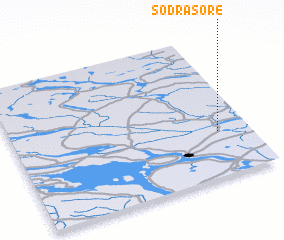 Places with similar names to Södra Söre, Sweden ::
Disclaimer :: Information on this page comes without warranty of any kind |
||
|
Where is Södra Söre? Elevation and coordinates ::
Latitude (lat): 63°19'0"N Longitude (lon): 14°52'0"E
(map arrows pan, magnifying glasses zoom) |
||
|
Visiting Södra Söre? Hotel/Accommodation ::
Book a hotel in Södra Söre Travel Guide ::
Buy a travel guide for Sweden rental cars ::
car rental offers GPS waypoint ::
download a GPX waypoint (PoI) of Södra Söre for your GPS receiver
|
||