|
search place name
|
||
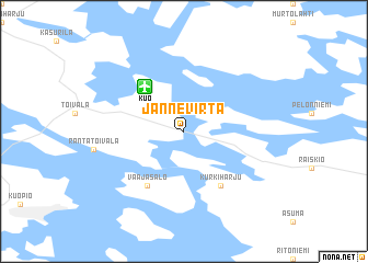
Jännevirta (Itä-Suomen Lääni, Finland)Jännevirta is a town in the Itä-Suomen Lääni region of Finland. An overview map of the region around Jännevirta is displayed below.
regional and 3d topo map of Jännevirta, Finland ::
Jännevirta airports ::
The nearest airport is KUO - Kuopio, located 4.9 km north of Jännevirta.
Other airports nearby include VRK - Varkaus (88.7 km south), JOE - Joensuu (96.6 km east), SVL - Savonlinna (127.7 km south east), MIK - Mikkeli (146.4 km south), Nearby towns ::
Rissala (4.1km north west) //
Vaajasalo (5.8km south) //
Kurkiharju (5.8km south) //
[all distances 'as the bird flies' and approximate] 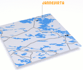 Places with similar names to Jännevirta, Finland ::
// Geneva Road (US)
Disclaimer :: Information on this page comes without warranty of any kind |
||
|
Where is Jännevirta? Elevation and coordinates ::
Latitude (lat): 62°58'0"N Longitude (lon): 27°50'0"E
(map arrows pan, magnifying glasses zoom) |
||
|
Visiting Jännevirta? Hotel/Accommodation ::
Book a hotel in Jännevirta Travel Guide ::
Buy a travel guide for Finland rental cars ::
car rental offers GPS waypoint ::
download a GPX waypoint (PoI) of Jännevirta for your GPS receiver
|
||