|
search place name
|
||
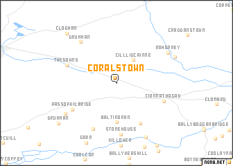
Coralstown (An Iarmhí, Ireland)Coralstown is a town in the An Iarmhí region of Ireland. An overview map of the region around Coralstown is displayed below.
regional and 3d topo map of Coralstown, Ireland ::
Coralstown airports ::
The nearest airport is DUB - Dublin, located 60.0 km east of Coralstown.
Other airports nearby include ENK - Enniskillen St Angelo (107.2 km north), NOC - Connaught (119.2 km north west), GWY - Galway (119.7 km west), SXL - Sligo (129.7 km north west), Nearby towns ::
Rathwire (3.2km north east) //
Killucan (4.1km north east) //
Cill Liúcainne (4.1km north east) //
Baltinoran (6.3km south) //
Ballinabrackey (6.9km south) //
Kinnegad (5.4km south east) //
Cionn Átha Gad (5.4km south east) //
Stonehouse (8.2km south) //
Pass of Kilbride (6.0km south west) //
Derrygawny (7.8km south) //
The Downs (5.6km north west) //
Drumman (7.5km north west) //
Milltownpass (7.0km south west) //
Raharney (7.0km north east) //
Castlejordan (9.1km south) //
Cloghan (9.3km north west) //
[all distances 'as the bird flies' and approximate]  Places with similar names to Coralstown, Ireland ::
// Karlstein (AT)
// Karlstein (DE)
// Karlstein (DE)
// Carlston (US)
// Karlstein (CZ)
// Karlsten (SE)
// Garlieston (GB)
// Carlos Dahne (BR)
Disclaimer :: Information on this page comes without warranty of any kind |
||
|
Where is Coralstown? Elevation and coordinates ::
Latitude (lat): 53°28'43"N Longitude (lon): 7°10'4"W
Elevation (approx.): 99m (map arrows pan, magnifying glasses zoom) |
||
|
Visiting Coralstown? Hotel/Accommodation ::
Book a hotel in Coralstown Travel Guide ::
Buy a travel guide for Ireland rental cars ::
car rental offers GPS waypoint ::
download a GPX waypoint (PoI) of Coralstown for your GPS receiver
|
||