|
search place name
|
||
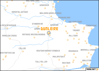
Dún Léire (Louth, Ireland)Dún Léire is a town in the Louth region of Ireland. An overview map of the region around Dún Léire is displayed below.
regional and 3d topo map of Dún Léire, Ireland ::
Dún Léire airports ::
The nearest airport is DUB - Dublin, located 46.8 km south of Dún Léire.
Other airports nearby include BFS - Belfast Aldergrove (92.3 km north), BHD - Belfast City (93.6 km north), ENK - Enniskillen St Angelo (103.3 km north west), IOM - Isle Of Man (119.6 km east), Nearby towns ::
Dunleer (0.0km north) //
Drumcar (3.1km north east) //
Dromin (2.9km north west) //
Kerney Cross Roads (4.3km north west) //
Stabannan (4.2km north west) //
Rathescar Cross Roads (3.5km west) //
Kilsaran (6.2km north) //
Keenanʼs Cross (4.1km north east) //
Clonmore (4.1km east) //
Newtown Monasterboice (6.9km south) //
Grangebellew (4.3km east) //
Dillonstown Cross (5.0km north east) //
Castlebellingham (7.3km north) //
Baile an Ghearlánaigh (7.3km north) //
Annagassan (6.6km north east) //
Ballymakenny (8.1km south east) //
[all distances 'as the bird flies' and approximate]  Places with similar names to Dún Léire, Ireland ::
Disclaimer :: Information on this page comes without warranty of any kind |
||
|
Where is Dún Léire? Elevation and coordinates ::
Latitude (lat): 53°50'6"N Longitude (lon): 6°23'46"W
Elevation (approx.): 21m (map arrows pan, magnifying glasses zoom) |
||
|
Visiting Dún Léire? Hotel/Accommodation ::
Book a hotel in Dún Léire Travel Guide ::
Buy a travel guide for Ireland rental cars ::
car rental offers GPS waypoint ::
download a GPX waypoint (PoI) of Dún Léire for your GPS receiver
|
||