|
search place name
|
||
Babajići (Croatia)Babajići is a town in Croatia. An overview map of the region around Babajići is displayed below.
regional and 3d topo map of Babajići, Croatia ::

Babajići airports ::
The nearest airport is SPU - Split, located 45.7 km west of Babajići.
Other airports nearby include OMO - Mostar (82.8 km east), SJJ - Sarajevo (126.6 km east), ZAD - Zadar (141.4 km north west), DBV - Dubrovnik (152.0 km south east), Nearby towns ::
Podgrađe (1.9km south) //
Kostanje (1.3km west) //
Kreševo (3.9km north) //
Seoca (3.3km north west) //
Slime (3.9km south) //
Zadvarje (3.8km south east) //
Katuni (4.1km north east) //
Pisak (5.6km south) //
Perišići (5.7km north) //
Kučiće (4.4km south west) //
Murati (6.0km north) //
Borovci (5.9km north) //
Kutleša (5.8km south west) //
Blato na Cetini (6.3km north) //
Kraljevići (6.7km north) //
Škarbići (6.5km north) //
Šestanovac (5.0km east) //
Smolonje (5.4km west) //
Trnbusi (6.5km north west) //
Smoljanovići (7.7km north west) //
Pleići (8.0km north west) //
Mandarići (8.6km north) //
Burazin Donji (8.3km north east) //
Rojnice (8.8km north) //
Tokići (8.6km north west) //
Gornja Brela (7.7km south east) //
Vrankovići (7.8km north west) //
Rajići (8.5km north east) //
Kujići (8.7km north east) //
[all distances 'as the bird flies' and approximate] 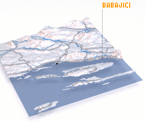 Places with similar names to Babajići, Croatia ::
// Babajići (BA)
Disclaimer :: Information on this page comes without warranty of any kind |
||
|
Where is Babajići? Elevation and coordinates ::
Latitude (lat): 43°27'0"N Longitude (lon): 16°51'0"E
Elevation (approx.): 233m (map arrows pan, magnifying glasses zoom) |
||
|
Visiting Babajići? Hotel/Accommodation ::
Book a hotel in Babajići Travel Guide ::
Buy a travel guide for Croatia rental cars ::
car rental offers GPS waypoint ::
download a GPX waypoint (PoI) of Babajići for your GPS receiver
|
||