|
search place name
|
||
Jujnovići (Croatia)Jujnovići is a town in Croatia. An overview map of the region around Jujnovići is displayed below.
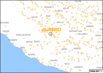
regional and 3d topo map of Jujnovići, Croatia ::
Jujnovići airports ::
The nearest airport is OMO - Mostar, located 52.3 km east of Jujnovići.
Other airports nearby include SPU - Split (79.3 km north west), SJJ - Sarajevo (110.5 km north east), DBV - Dubrovnik (117.0 km south east), TIV - Tivat (156.8 km south east), Nearby towns ::
Donji Ravlići (0.9km north) //
Kozica (0.7km north east) //
Pavići (0.7km east) //
Katići (1.1km north east) //
Pošta (0.9km east) //
Bušelići (1.7km north) //
Marasi (1.5km west) //
Rotni Dolac (2.1km north) //
Donji Begovići (2.1km south) //
Okmadžići (1.6km west) //
Vuletići (1.6km east) //
Gornji Ravlići (2.0km north east) //
Ljubeć (1.9km north west) //
Kozica (2.6km south west) //
Majstorovići (2.4km south east) //
Gornji Antunovići (2.1km north east) //
Rudeži (2.6km north east) //
Vekići (3.1km north) //
Vlaka (2.8km south east) //
Gornji Begovići (3.1km south west) //
Saranač (2.7km south west) //
Gomila (3.1km north west) //
Grgići (3.0km south east) //
Vodenjak (3.5km north) //
Belaići (3.6km north) //
Družijanići (3.3km north west) //
Dumići (4.1km south) //
Vujčići (3.4km south east) //
Knezovići (4.4km north) //
[all distances 'as the bird flies' and approximate] 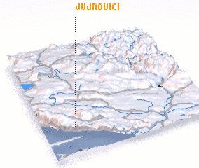 Places with similar names to Jujnovići, Croatia :: Disclaimer :: Information on this page comes without warranty of any kind |
||
|
Where is Jujnovići? Elevation and coordinates ::
Latitude (lat): 43°15'53"N Longitude (lon): 17°12'7"E
Elevation (approx.): 345m (map arrows pan, magnifying glasses zoom) |
||
|
Visiting Jujnovići? Hotel/Accommodation ::
Book a hotel in Jujnovići Travel Guide ::
Buy a travel guide for Croatia rental cars ::
car rental offers GPS waypoint ::
download a GPX waypoint (PoI) of Jujnovići for your GPS receiver
|
||