|
search place name
|
||
Novo Brdo (Croatia)Novo Brdo is a town in Croatia. An overview map of the region around Novo Brdo is displayed below.
regional and 3d topo map of Novo Brdo, Croatia ::

Novo Brdo airports ::
The nearest airport is ZAG - Zagreb, located 64.7 km north west of Novo Brdo.
Other airports nearby include MBX - Maribor (141.0 km north west), OSI - Osijek (156.3 km east), ZAD - Zadar (191.8 km south west), GRZ - Graz (198.2 km north west), Nearby towns ::
Husain (1.0km south) //
Staro Brdo (0.8km east) //
Batina (1.3km south east) //
Mišinka (1.2km north east) //
Selište (2.0km east) //
Kutina (2.5km west) //
Šartovac (3.6km north) //
Gojilce (2.7km east) //
Staro Brdo (3.0km south east) //
Novo Brdo (3.0km south east) //
Kutinska Slatina (4.3km north west) //
Gojlo (4.1km east) //
Bezgova Greda (4.7km south east) //
Stupovača (5.7km north) //
Brinjani (5.8km north) //
Tavani (5.1km south east) //
Piljenice (6.3km south east) //
Kutinske Čaire (7.3km north) //
Čaire (7.5km north) //
Ilova (5.9km south east) //
Zbjegovača (6.2km south east) //
Rogoža (8.1km north east) //
Veliko Vukovje (7.2km north east) //
Srpsko Selište (8.9km north west) //
Ciglenica (8.2km north west) //
Brdašce (9.2km south east) //
Mikleuška (9.7km north west) //
[all distances 'as the bird flies' and approximate] 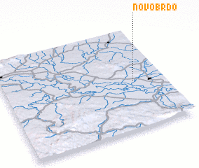 Places with similar names to Novo Brdo, Croatia ::
// Novo Bŭrdo (BG)
// Novyy Brod (UA)
// Novyy Brod (RU)
// Novyye Brody (RU)
// Novo Brdo (HR)
// Novo Brdo (CS)
Disclaimer :: Information on this page comes without warranty of any kind |
||
|
Where is Novo Brdo? Elevation and coordinates ::
Latitude (lat): 45°29'0"N Longitude (lon): 16°48'40"E
Elevation (approx.): 157m (map arrows pan, magnifying glasses zoom) |
||
|
Visiting Novo Brdo? Hotel/Accommodation ::
Book a hotel in Novo Brdo Travel Guide ::
Buy a travel guide for Croatia rental cars ::
car rental offers GPS waypoint ::
download a GPX waypoint (PoI) of Novo Brdo for your GPS receiver
|
||