|
search place name
|
||
Šajfari (Croatia)Šajfari is a town in Croatia. An overview map of the region around Šajfari is displayed below.
regional and 3d topo map of Šajfari, Croatia ::

Šajfari airports ::
The nearest airport is ZAG - Zagreb, located 79.2 km north east of Šajfari.
Other airports nearby include RJK - Rijeka (87.8 km west), ZAD - Zadar (111.8 km south), PUY - Pula (139.6 km west), MBX - Maribor (154.8 km north), Nearby towns ::
Čamerovac (0.6km north west) //
Mikići (0.7km north east) //
Špoljarići (0.7km west) //
Pleševo Selo (1.1km north west) //
Salopek Selo (1.4km south) //
Polje (1.3km south west) //
Arapovac (1.6km north west) //
Ugarkovići (2.0km north) //
Barić Selo (1.5km east) //
Donji Furjan (2.2km south) //
Poljani (2.3km south) //
Dubrave (2.2km north east) //
Hrvojevići (2.2km north east) //
Selište Lađevačko (2.4km north west) //
Gornji Furjan (2.8km south) //
Furjan (2.9km south east) //
Salopek Luke (2.4km north east) //
Gornji Lađevac (2.5km north west) //
Božići (2.4km east) //
Mrkonja (2.7km south west) //
Skukani (2.5km east) //
Grgetić (3.4km north east) //
Božić Brdo (3.0km south east) //
Trnovi (2.9km east) //
Radočaji (3.5km north west) //
Videkić Selo (3.5km south west) //
Donji Lađevac (3.1km west) //
Donji Gnojnice (4.4km north) //
Pašići (3.8km south west) //
[all distances 'as the bird flies' and approximate] 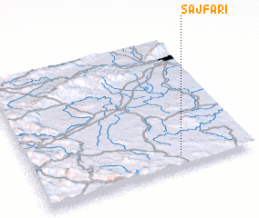 Places with similar names to Šajfari, Croatia ::
// Sagevere (EE)
// Suijavaara (SE)
Disclaimer :: Information on this page comes without warranty of any kind |
||
|
Where is Šajfari? Elevation and coordinates ::
Latitude (lat): 45°5'14"N Longitude (lon): 15°40'17"E
Elevation (approx.): 258m (map arrows pan, magnifying glasses zoom) |
||
|
Visiting Šajfari? Hotel/Accommodation ::
Book a hotel in Šajfari Travel Guide ::
Buy a travel guide for Croatia rental cars ::
car rental offers GPS waypoint ::
download a GPX waypoint (PoI) of Šajfari for your GPS receiver
|
||