|
search place name
|
||
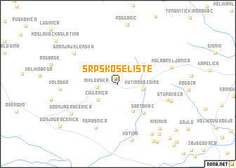
Srpsko Selište (Croatia)Srpsko Selište is a town in Croatia. An overview map of the region around Srpsko Selište is displayed below.
regional and 3d topo map of Srpsko Selište, Croatia ::
Srpsko Selište airports ::
The nearest airport is ZAG - Zagreb, located 57.9 km west of Srpsko Selište.
Other airports nearby include MBX - Maribor (132.3 km north west), GRZ - Graz (189.3 km north west), ZAD - Zadar (195.9 km south west), SJJ - Sarajevo (229.1 km south east), Nearby towns ::
Mikleuška (2.4km west) //
Ciglenica (3.3km south west) //
Kutinske Čaire (2.9km east) //
Čaire (3.0km east) //
Kutinska Slatina (4.6km south) //
Kutinica (4.3km north east) //
Šartovac (5.4km south east) //
Repušnica (7.4km south) //
Brinjani (6.1km south east) //
Gornja Jelenska (6.9km north west) //
Gornja Gračenica (7.0km south west) //
Stupovača (6.5km south east) //
Mala Bršljanica (6.5km north east) //
Novo Brdo (8.9km south east) //
Mišinka (8.5km south east) //
Staro Brdo (9.2km south east) //
Selište (10.4km south east) //
[all distances 'as the bird flies' and approximate] 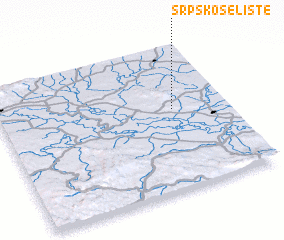 Places with similar names to Srpsko Selište, Croatia :: Disclaimer :: Information on this page comes without warranty of any kind |
||
|
Where is Srpsko Selište? Elevation and coordinates ::
Latitude (lat): 45°33'20"N Longitude (lon): 16°45'44"E
Elevation (approx.): 161m (map arrows pan, magnifying glasses zoom) |
||
|
Visiting Srpsko Selište? Hotel/Accommodation ::
Book a hotel in Srpsko Selište Travel Guide ::
Buy a travel guide for Croatia rental cars ::
car rental offers GPS waypoint ::
download a GPX waypoint (PoI) of Srpsko Selište for your GPS receiver
|
||