|
search place name
|
||
LʼAngerie (Pays de la Loire, France)LʼAngerie is a town in the Pays de la Loire region of France. An overview map of the region around LʼAngerie is displayed below.
regional and 3d topo map of LʼAngerie, France ::

LʼAngerie airports ::
The nearest airport is LME - Le Mans Arnage, located 35.9 km south west of LʼAngerie.
Other airports nearby include TUF - Tours Val De Loire (84.8 km south), ORE - Orleans Bricy (94.0 km east), LVA - Laval Entrammes (96.5 km west), CFR - Caen Carpiquet (131.8 km north west), Nearby towns ::
La Bosse (1.9km south) //
Le Boulay (2.2km north west) //
La Tannerie (3.7km north) //
Saint-Denis-des-Coudrais (3.9km south) //
Chapeau (3.1km north west) //
Guermet (3.1km north west) //
Saint-Georges-du-Rosay (3.1km north west) //
Dehault (4.5km north east) //
Le Regret (4.5km north east) //
Les Mousseries (3.7km east) //
Les Peloiries (4.1km south west) //
Les Maraisières (4.1km south west) //
Saint-Aubin-des-Coudrais (4.1km south east) //
Le Boulay (5.7km south) //
La Cohinerie (5.7km south) //
Prévelles (5.2km south west) //
La Coudre (5.2km south west) //
La Contrie (5.2km north west) //
Boëssé-le-Sec (6.1km south east) //
Saint-Hilaire-le-Lierru (7.4km south) //
Tuffé (7.5km south) //
La Bourdinière (7.5km north) //
Nogent-le-Bernard (6.7km north west) //
Haute Biche (6.7km north east) //
Saint-Martin-des-Monts (6.2km south east) //
La Chapelle-du-Bois (6.2km north east) //
La Durandière (7.8km north) //
Les Arpens (7.8km north) //
Villaines-la-Gonais (7.4km south east) //
[all distances 'as the bird flies' and approximate] 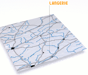 Places with similar names to LʼAngerie, France ::
Disclaimer :: Information on this page comes without warranty of any kind |
||
|
Where is LʼAngerie? Elevation and coordinates ::
Latitude (lat): 48°11'0"N Longitude (lon): 0°32'0"W
Elevation (approx.): 148m (map arrows pan, magnifying glasses zoom) |
||
|
Visiting LʼAngerie? Hotel/Accommodation ::
Book a hotel in LʼAngerie Travel Guide ::
Buy a travel guide for France rental cars ::
car rental offers GPS waypoint ::
download a GPX waypoint (PoI) of LʼAngerie for your GPS receiver
|
||