|
search place name
|
||
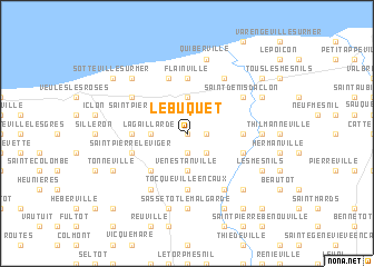
Le Buquet (Haute-Normandie, France)Le Buquet is a town in the Haute-Normandie region of France. An overview map of the region around Le Buquet is displayed below.
regional and 3d topo map of Le Buquet, France ::
Le Buquet airports ::
The nearest airport is URO - Rouen Vallee De Seine, located 53.8 km south of Le Buquet.
Other airports nearby include LEH - Le Havre Octeville (67.4 km south west), DOL - Deauville St Gatien (74.9 km south west), LTQ - Le Tourquet Le Touquet Paris Plage (91.9 km north east), BVA - Beauvais Tille (97.2 km south east), Nearby towns ::
Bosc-le-Comte (0.0km north) //
Gruchet-Saint-Siméon (1.9km south) //
Luneray (1.2km east) //
Greuville (2.2km south east) //
Le Beau-Fournier (2.2km north east) //
La Gaillarde (2.4km west) //
Vénestanville (3.7km south) //
Le Bourg-Dun (3.7km north) //
Saint-Pierre-le-Vieux (3.0km north west) //
Avremesnil (3.0km north east) //
Crasville-la-Rocquefort (4.4km south west) //
Autigny (4.4km south west) //
Flainville (5.6km north) //
Tocqueville-en-Caux (5.6km south) //
Gourel (3.6km east) //
Le Roquet (3.6km west) //
Brachy (4.0km south east) //
Fontaine-le-Dun (4.0km south west) //
Saint-Pierre-le-Viger (4.0km south west) //
Englesqueville (5.7km north) //
Saint-Aubin-sur-Mer (5.7km north) //
Rainfreville (6.1km south east) //
Biville-la-Rivière (6.1km south east) //
Brametot (6.1km south west) //
Blainville (6.1km north east) //
Saint-Denis-dʼAclon (5.2km north east) //
La Chapelle-sur-Dun (5.2km north west) //
Sassetot-le-Malgardé (7.4km south) //
Gonnetot (7.4km south) //
[all distances 'as the bird flies' and approximate] 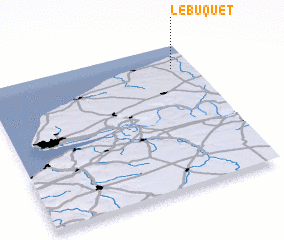 Places with similar names to Le Buquet, France ::
// Labukta (NO)
// Loabukit (ID)
// La Boquita (MX)
// La Boquita (MX)
// La Boquita (HN)
// La Boquita (VE)
// La Boquita (VE)
// La Boquita (NI)
// Labi Cade (SO)
// La Boicate (HT)
Disclaimer :: Information on this page comes without warranty of any kind |
||
|
Where is Le Buquet? Elevation and coordinates ::
Latitude (lat): 49°50'0"N Longitude (lon): 0°54'0"W
Elevation (approx.): 65m (map arrows pan, magnifying glasses zoom) |
||
|
Visiting Le Buquet? Hotel/Accommodation ::
Book a hotel in Le Buquet Travel Guide ::
Buy a travel guide for France rental cars ::
car rental offers GPS waypoint ::
download a GPX waypoint (PoI) of Le Buquet for your GPS receiver
|
||