|
search place name
|
||
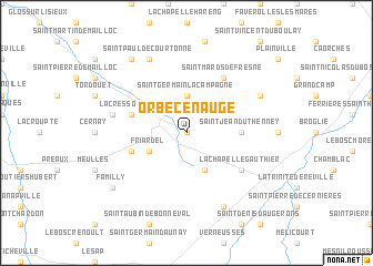
Orbec-en-Auge (Basse-Normandie, France)Orbec-en-Auge is a town in the Basse-Normandie region of France. An overview map of the region around Orbec-en-Auge is displayed below.
regional and 3d topo map of Orbec-en-Auge, France ::
Orbec-en-Auge airports ::
The nearest airport is DOL - Deauville St Gatien, located 43.2 km north west of Orbec-en-Auge.
Other airports nearby include LEH - Le Havre Octeville (62.3 km north), CFR - Caen Carpiquet (65.6 km west), URO - Rouen Vallee De Seine (68.7 km north east), POX - Pontoise Cormeilles En Vexin (119.0 km east), Nearby towns ::
La Vespière (0.0km north) //
Saint-Germain-la-Campagne (3.7km north) //
La Folletière-Abenon (3.9km south) //
Friardel (3.1km south west) //
Saint-Jean-du-Thenney (3.6km east) //
La Cressonnière (4.1km north west) //
Cerqueux (4.1km south west) //
Saint-Mards-de-Fresne (6.1km north east) //
La Chapelle-Gauthier (5.2km south east) //
Saint-Martin-de-Bienfaite (5.2km west) //
Capelle-les-Grands (6.1km north east) //
Saint-Paul-de-Courtonne (7.8km north) //
La Goulafrière (7.8km south) //
Courtonne-la-Ville (8.3km north west) //
Familly (7.4km south west) //
[all distances 'as the bird flies' and approximate] 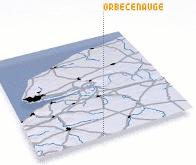 Places with similar names to Orbec-en-Auge, France :: Disclaimer :: Information on this page comes without warranty of any kind |
||
|
Where is Orbec-en-Auge? Elevation and coordinates ::
Latitude (lat): 49°1'0"N Longitude (lon): 0°25'0"W
Elevation (approx.): 148m (map arrows pan, magnifying glasses zoom) |
||
|
Visiting Orbec-en-Auge? Hotel/Accommodation ::
Book a hotel in Orbec-en-Auge Travel Guide ::
Buy a travel guide for France rental cars ::
car rental offers GPS waypoint ::
download a GPX waypoint (PoI) of Orbec-en-Auge for your GPS receiver
|
||