|
search place name
|
||
Saint-Cierge-sous-le-Cheylard (Rhône-Alpes, France)Saint-Cierge-sous-le-Cheylard is a town in the Rhône-Alpes region of France. An overview map of the region around Saint-Cierge-sous-le-Cheylard is displayed below.
regional and 3d topo map of Saint-Cierge-sous-le-Cheylard, France ::

Saint-Cierge-sous-le-Cheylard airports ::
The nearest airport is VAF - Valence Chabeuil, located 39.7 km east of Saint-Cierge-sous-le-Cheylard.
Other airports nearby include OBS - Aubenas-vals-lanas Ardeche Meridionale (43.9 km south), LPY - Le Puy Loudes (57.8 km west), EBU - St.-etienne Boutheon (68.8 km north), GNB - Grenoble Saint Geoirs (83.0 km north east), Nearby towns ::
Pourchoie (1.3km east) //
Jabrezac (1.3km west) //
Nonières (2.6km east) //
Saint-Michel-dʼAurance (3.7km south) //
Le Moumier (3.7km north) //
Le Pouzat (3.7km north) //
Les Seuls (3.2km south east) //
Les Sauzets (3.2km south east) //
Burianne (3.9km south) //
Bonnet (3.2km north east) //
Bleyssac (3.9km north) //
Saint-Jean-Roure (3.2km north west) //
Bessac (3.2km north west) //
Saint-Barthélemy-le-Meil (4.5km south east) //
Sarny (4.5km south east) //
Le Peyron (4.5km north east) //
Ébruv (4.5km north east) //
Darne (4.4km north west) //
Saint-Prix (4.4km north east) //
Prachazale (4.4km north east) //
La Roure (5.7km south) //
Le Coudiol (5.4km south west) //
Le Cheylard (5.4km south west) //
La Gueze (6.1km north west) //
Lichessol (6.1km north west) //
Beauvert (5.4km north west) //
Saint-Christol (6.1km south west) //
Le Fau (7.4km south) //
Mirabel (7.4km south) //
[all distances 'as the bird flies' and approximate] 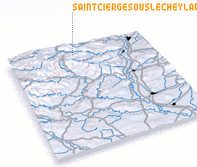 Places with similar names to Saint-Cierge-sous-le-Cheylard, France :: Disclaimer :: Information on this page comes without warranty of any kind |
||
|
Where is Saint-Cierge-sous-le-Cheylard? Elevation and coordinates ::
Latitude (lat): 44°56'0"N Longitude (lon): 4°28'0"E
Elevation (approx.): 752m (map arrows pan, magnifying glasses zoom) |
||
|
Visiting Saint-Cierge-sous-le-Cheylard? Hotel/Accommodation ::
Book a hotel in Saint-Cierge-sous-le-Cheylard Travel Guide ::
Buy a travel guide for France rental cars ::
car rental offers GPS waypoint ::
download a GPX waypoint (PoI) of Saint-Cierge-sous-le-Cheylard for your GPS receiver
|
||