|
search place name
|
||
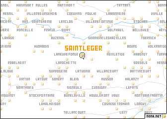
Saint-Léger (Luxembourg, Belgium)Saint-Léger is a town in the Luxembourg region of Belgium. An overview map of the region around Saint-Léger is displayed below.
regional and 3d topo map of Saint-Léger, Belgium ::
Saint-Léger airports ::
The nearest airport is LUX - Luxemburg Luxembourg, located 40.6 km east of Saint-Léger.
Other airports nearby include MZM - Metz Frescaty (70.0 km south east), ETZ - Metz Nancy Lorraine (83.0 km south east), SPM - Spangdahlem Ab (84.9 km north east), ZQF - Trier Fohren (86.5 km east), Nearby towns ::
Wachet (1.2km east) //
Chantemelle (3.7km north) //
La Neuve Forge (2.4km west) //
La Tuerie (3.7km south) //
La Rochette (3.0km south west) //
Mussy-la-Ville (3.9km south) //
Châtillon (4.1km north east) //
Laclaireau (4.1km south west) //
Bleid (5.7km south) //
Derrière les Hazelles (5.2km north east) //
Le Faubourg (6.1km north east) //
Buzenol (5.2km north west) //
Sivry (6.1km north west) //
Baranzy (6.1km south east) //
Willancourt (5.2km south east) //
Sur Rogène (5.2km south west) //
Gévimont (5.2km south west) //
Meix-le-Tige (4.8km east) //
Ville-Houdlémont (7.4km south) //
Vance (7.5km north) //
Signeulx (7.5km south) //
Gennevaux (6.6km south east) //
Musson (6.6km south east) //
Gomery (6.6km south west) //
Baconveau (6.6km south west) //
Villers-Tortrue (7.8km north) //
Lenclos (7.8km north) //
Cussigny (7.8km south) //
Saint-Remy (7.8km south) //
[all distances 'as the bird flies' and approximate] 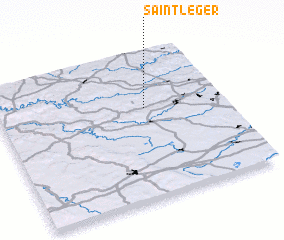 Places with similar names to Saint-Léger, Belgium ::
// Saint-Léger (HT)
// Saint-Léger (FR)
// Saint-Léger (FR)
// Saint-Lager (FR)
// Saint-Léger (FR)
// Saint-Léger (FR)
// Saint-Léger (FR)
// Saint-Léger (FR)
// Saint-Léger (FR)
// Saint-Léger (BE)
Disclaimer :: Information on this page comes without warranty of any kind |
||
|
Where is Saint-Léger? Elevation and coordinates ::
Latitude (lat): 49°37'0"N Longitude (lon): 5°39'0"E
Elevation (approx.): 285m (map arrows pan, magnifying glasses zoom) |
||
|
Visiting Saint-Léger? Hotel/Accommodation ::
Book a hotel in Saint-Léger Travel Guide ::
Buy a travel guide for Belgium rental cars ::
car rental offers GPS waypoint ::
download a GPX waypoint (PoI) of Saint-Léger for your GPS receiver
|
||