|
search place name
|
||
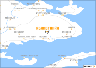
Aganotaíika (Piraiévs, Greece)Aganotaíika is a town in the Piraiévs region of Greece. An overview map of the region around Aganotaíika is displayed below.
regional and 3d topo map of Aganotaíika, Greece ::
Aganotaíika airports ::
The nearest airport is KLX - Kalamata, located 128.5 km west of Aganotaíika.
Other airports nearby include KIT - Kithira (133.1 km south), JMK - Mykonos Mikonos (172.4 km east), GPA - Patras Araxos (191.3 km north west), JSI - Skiathos Alexandros Papadiamantis (193.8 km north), Nearby towns ::
Metókhion (1.9km south) //
Pigádhia (2.4km south west) //
Plépi (4.8km south west) //
Psomaíika (5.9km east) //
Vlakhaíika (6.2km east) //
Áyios Yeóryios (7.6km north) //
Troizín (8.0km north) //
Galatás (8.6km north east) //
Póros (8.7km north east) //
[all distances 'as the bird flies' and approximate]  Places with similar names to Aganotaíika, Greece ::
// Akondok (CM)
// Agondogui (BJ)
// Aucantagua (PE)
// Akuntak (NG)
// Agandagu (PG)
// Akounadougou (CI)
Disclaimer :: Information on this page comes without warranty of any kind |
||
|
Where is Aganotaíika? Elevation and coordinates ::
Latitude (lat): 37°26'0"N Longitude (lon): 23°24'0"E
Elevation (approx.): 172m (map arrows pan, magnifying glasses zoom) |
||
|
Visiting Aganotaíika? Hotel/Accommodation ::
Book a hotel in Aganotaíika Travel Guide ::
Buy a travel guide for Greece rental cars ::
car rental offers GPS waypoint ::
download a GPX waypoint (PoI) of Aganotaíika for your GPS receiver
|
||