|
search place name
|
||
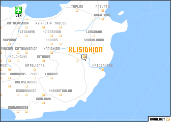
Klisídhion (Piraiévs, Greece)Klisídhion is a town in the Piraiévs region of Greece. An overview map of the region around Klisídhion is displayed below.
regional and 3d topo map of Klisídhion, Greece ::
Klisídhion airports ::
The nearest airport is JSH - Sitia, located 16.3 km north west of Klisídhion.
Other airports nearby include KSJ - Kasos (70.2 km north east), AOK - Karpathos (89.7 km north east), HER - Heraklion Nikos Kazantzakis (99.0 km west), JTR - Santorini (157.8 km north west), Nearby towns ::
Zákros (1.5km west) //
Kellária (2.4km north west) //
Adhravástoi (2.4km north west) //
Azokéramos (2.4km north east) //
Khokhlakiaí (4.0km north) //
Káto Zákros (3.6km south east) //
Langádha (5.8km north) //
Vrisídhion (5.9km north west) //
Karídhion (6.3km west) //
Xirolímni (7.2km north west) //
Mitáton (7.1km north west) //
Khónos (7.1km north west) //
Lamnóni (7.1km south west) //
Thólos (8.7km north west) //
Krionérion (8.2km north west) //
Khamaítoulon (8.7km south west) //
[all distances 'as the bird flies' and approximate] 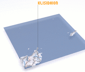 Places with similar names to Klisídhion, Greece :: Disclaimer :: Information on this page comes without warranty of any kind |
||
|
Where is Klisídhion? Elevation and coordinates ::
Latitude (lat): 35°7'0"N Longitude (lon): 26°14'0"E
Elevation (approx.): 165m (map arrows pan, magnifying glasses zoom) |
||
|
Visiting Klisídhion? Hotel/Accommodation ::
Book a hotel in Klisídhion Travel Guide ::
Buy a travel guide for Greece rental cars ::
car rental offers GPS waypoint ::
download a GPX waypoint (PoI) of Klisídhion for your GPS receiver
|
||