|
search place name
|
||
Levkákia (Piraiévs, Greece)Levkákia is a town in the Piraiévs region of Greece. An overview map of the region around Levkákia is displayed below.
regional and 3d topo map of Levkákia, Greece ::

Levkákia airports ::
The nearest airport is KLX - Kalamata, located 91.7 km south west of Levkákia.
Other airports nearby include KIT - Kithira (142.2 km south), GPA - Patras Araxos (143.3 km north west), PYR - Andravida (144.7 km west), ZTH - Zakynthos Dionysios Solomos (176.4 km west), Nearby towns ::
Asíni (NaNkm north) //
Dhrépanon (1.5km east) //
Tsélon (1.5km west) //
Kallithéa (2.4km south east) //
Piryiótika (4.0km north) //
Tolón (4.0km south) //
Exóstis (3.5km north west) //
Ária (3.5km north west) //
Marathéa (4.4km east) //
Vivári (4.8km south east) //
Áyios Adhrianós (6.3km north west) //
Náfplion (5.4km west) //
Néon Roinón (7.6km north) //
Néa Tírins (7.1km north west) //
Tírins (8.1km north west) //
Argolikón (9.5km north west) //
[all distances 'as the bird flies' and approximate] 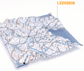
Disclaimer :: Information on this page comes without warranty of any kind |
||
|
Where is Levkákia? Elevation and coordinates ::
Latitude (lat): 37°33'0"N Longitude (lon): 22°52'0"E
Elevation (approx.): 17m (map arrows pan, magnifying glasses zoom) |
||
|
Visiting Levkákia? Hotel/Accommodation ::
Book a hotel in Levkákia Travel Guide ::
Buy a travel guide for Greece rental cars ::
car rental offers GPS waypoint ::
download a GPX waypoint (PoI) of Levkákia for your GPS receiver
|
||