|
search place name
|
||
Plomárion (Lésvos, Greece)Plomárion is a town in the Lésvos region of Greece. An overview map of the region around Plomárion is displayed below.
regional and 3d topo map of Plomárion, Greece ::

nearby GPS traces from timatio ::
Plomárion airports ::
The nearest airport is MJT - Mytilini Mitilini, located 21.8 km north east of Plomárion.
Other airports nearby include JKH - Chios (73.1 km south), IGL - Izmir Cigli (75.9 km south east), ADB - Izmir Adnan Menderes (102.4 km south east), LXS - Limnos (142.8 km north west), Nearby towns ::
Plagiá (1.5km north east) //
Trýgonas (2.9km east) //
Megalochórion (4.7km north) //
Palaiochórion (5.1km north west) //
Melínta (5.1km west) //
Neochórion (7.1km north west) //
Borós (7.7km north west) //
Akrásion (7.6km north west) //
Ampelikón (9.3km north west) //
Mesagrós (9.4km north east) //
[all distances 'as the bird flies' and approximate] 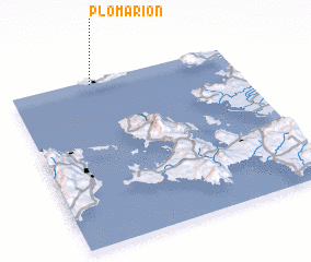 Places with similar names to Plomárion, Greece ::
// Plum Run (US)
// Palaiomoírion (GR)
// Palamárion (GR)
// Palamárion (GR)
// Plum Run (US)
// Pelamburan (ID)
// Palmarin (SN)
// Palmerani (PE)
// Palmeirina (BR)
// Plum Run (US)
Disclaimer :: Information on this page comes without warranty of any kind |
||
|
Where is Plomárion? Elevation and coordinates ::
Latitude (lat): 38°58'36"N Longitude (lon): 26°22'5"E
Elevation (approx.): 18m (map arrows pan, magnifying glasses zoom) |
||
|
Visiting Plomárion? Hotel/Accommodation ::
Book a hotel in Plomárion Travel Guide ::
Buy a travel guide for Greece rental cars ::
car rental offers GPS waypoint ::
download a GPX waypoint (PoI) of Plomárion for your GPS receiver
|
||