|
search place name
|
||
Zacharáton (Kilkís, Greece)Zacharáton is a town in the Kilkís region of Greece. An overview map of the region around Zacharáton is displayed below.
regional and 3d topo map of Zacharáton, Greece ::

Zacharáton airports ::
The nearest airport is SKG - Thessaloniki Makedonia, located 56.4 km south of Zacharáton.
Other airports nearby include KZI - Kozani Filippos (120.5 km south west), KVA - Kavala Megas Alexandros Intl (146.4 km east), SKP - Skopje (148.3 km north west), KSO - Kastoria Aristotelis (149.9 km south west), Nearby towns ::
Xiróvrysi (1.7km north west) //
Kilkís (3.8km south) //
Efkarpía (5.5km north) //
Argyroúpolis (5.0km south east) //
Koiládion (6.4km north) //
Koromiléa (6.4km north west) //
Cheimadión (7.2km north) //
Térpyllos (5.6km east) //
Dipótamos (5.5km east) //
Áno Potamiá (7.0km south east) //
Sevastón (6.6km south east) //
Metallikón (6.3km west) //
Kristóni (8.0km south) //
Metaxochórion (7.5km north east) //
Káto Potamiá (8.5km south east) //
Gerakárion (9.1km north) //
Plagiá (9.5km north west) //
Leventochórion (10.1km south west) //
[all distances 'as the bird flies' and approximate] 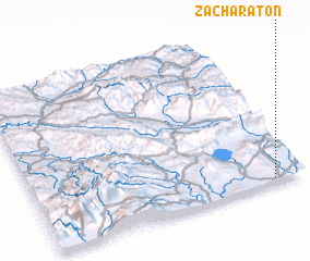 Places with similar names to Zacharáton, Greece ::
// Zacharytown (US)
// Suchá Rudná (CZ)
Disclaimer :: Information on this page comes without warranty of any kind |
||
|
Where is Zacharáton? Elevation and coordinates ::
Latitude (lat): 41°1'26"N Longitude (lon): 22°53'11"E
Elevation (approx.): 269m (map arrows pan, magnifying glasses zoom) |
||
|
Visiting Zacharáton? Hotel/Accommodation ::
Book a hotel in Zacharáton Travel Guide ::
Buy a travel guide for Greece rental cars ::
car rental offers GPS waypoint ::
download a GPX waypoint (PoI) of Zacharáton for your GPS receiver
|
||