|
search place name
|
||
Arrão de Cima (Portalegre, Portugal)Arrão de Cima is a town in the Portalegre region of Portugal. An overview map of the region around Arrão de Cima is displayed below.
regional and 3d topo map of Arrão de Cima, Portugal ::

Arrão de Cima airports ::
The nearest airport is LIS - Lisbon Lisboa, located 84.5 km south west of Arrão de Cima.
Other airports nearby include BJZ - Badajoz Talavera La Real (129.8 km east), Nearby towns ::
Pernancha de Baixo (2.9km east) //
Monte do Rosmaninhal (4.0km north) //
Formosa (5.6km south) //
Monte da Silveira (4.3km west) //
Quinta (4.7km north east) //
Pernancha do Meio (4.7km north east) //
Valongo (5.7km north west) //
Marmeleiro (6.3km north west) //
Ferro das Vacas (5.7km east) //
Casal de Martim Gil (7.4km north) //
Pernancha de Cima (6.0km east) //
Corsas (7.6km south) //
Talasnas (7.0km north west) //
Pipa (6.8km south east) //
Maltim de Baixo (8.0km south) //
Pego da Curva (6.8km north west) //
Pombas (8.6km north east) //
Caveira (9.4km north east) //
Cavaleiros (9.4km south east) //
[all distances 'as the bird flies' and approximate] 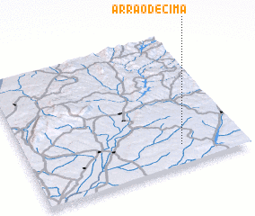 Places with similar names to Arrão de Cima, Portugal ::
// Areia de Cima (PT)
// Ardo Sambo (NG)
Disclaimer :: Information on this page comes without warranty of any kind |
||
|
Where is Arrão de Cima? Elevation and coordinates ::
Latitude (lat): 39°9'0"N Longitude (lon): 8°17'0"W
Elevation (approx.): 128m (map arrows pan, magnifying glasses zoom) |
||
|
Visiting Arrão de Cima? Hotel/Accommodation ::
Book a hotel in Arrão de Cima Travel Guide ::
Buy a travel guide for Portugal rental cars ::
car rental offers GPS waypoint ::
download a GPX waypoint (PoI) of Arrão de Cima for your GPS receiver
|
||