|
search place name
|
||
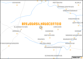
Brejo da Silha do Centeio (Setúbal, Portugal)Brejo da Silha do Centeio is a town in the Setúbal region of Portugal. An overview map of the region around Brejo da Silha do Centeio is displayed below.
regional and 3d topo map of Brejo da Silha do Centeio, Portugal ::
Brejo da Silha do Centeio airports ::
The nearest airport is LIS - Lisbon Lisboa, located 88.4 km north west of Brejo da Silha do Centeio.
Other airports nearby include FAO - Faro (137.1 km south), BJZ - Badajoz Talavera La Real (163.6 km north east), Nearby towns ::
Casa Nova do Seisal (0.0km north) //
Sismarias (3.5km south east) //
Ponto Carro (4.7km south east) //
Mascarenhas (4.7km south east) //
Pedrões (5.6km south) //
Caniceira (5.8km east) //
Vale de Joana (7.6km south) //
[all distances 'as the bird flies' and approximate] 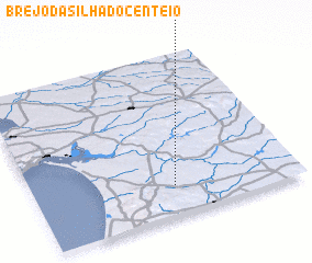 Places with similar names to Brejo da Silha do Centeio, Portugal :: Disclaimer :: Information on this page comes without warranty of any kind |
||
|
Where is Brejo da Silha do Centeio? Elevation and coordinates ::
Latitude (lat): 38°11'0"N Longitude (lon): 8°28'0"W
Elevation (approx.): 88m (map arrows pan, magnifying glasses zoom) |
||
|
Visiting Brejo da Silha do Centeio? Hotel/Accommodation ::
Book a hotel in Brejo da Silha do Centeio Travel Guide ::
Buy a travel guide for Portugal rental cars ::
car rental offers GPS waypoint ::
download a GPX waypoint (PoI) of Brejo da Silha do Centeio for your GPS receiver
|
||