|
search place name
|
||
Pedrógão (Leiria, Portugal)Pedrógão is a town in the Leiria region of Portugal. An overview map of the region around Pedrógão is displayed below.
regional and 3d topo map of Pedrógão, Portugal ::

Pedrógão airports ::
The nearest airport is LIS - Lisbon Lisboa, located 127.1 km south of Pedrógão.
Other airports nearby include OPO - Porto (149.6 km north), VRL - Vila Real (183.2 km north east), Nearby towns ::
Casal da Anja (4.7km south east) //
Galeota (4.7km south east) //
Vieira de Leiria (5.7km south) //
Casal dos Lobos (5.7km south) //
Praia da Vieira (5.7km south) //
Passagem (6.2km south east) //
Ervedeira (5.7km east) //
Coimbrão (6.0km east) //
Carvide (7.0km south east) //
Lameiro (7.0km south east) //
Água Formosa (7.9km south) //
Charneca dos Moinhos (7.9km south) //
Moinhos (8.6km south east) //
Gândara de Baixo (8.6km south east) //
Gândara de Além (8.6km south east) //
Carpalho (8.6km south east) //
Granja (9.3km south east) //
Gândara de Aquém (9.3km south east) //
[all distances 'as the bird flies' and approximate] 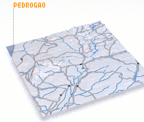 Places with similar names to Pedrógão, Portugal ::
Disclaimer :: Information on this page comes without warranty of any kind |
||
|
Where is Pedrógão? Elevation and coordinates ::
Latitude (lat): 39°55'0"N Longitude (lon): 8°57'0"W
Elevation (approx.): 26m (map arrows pan, magnifying glasses zoom) |
||
|
Visiting Pedrógão? Hotel/Accommodation ::
Book a hotel in Pedrógão Travel Guide ::
Buy a travel guide for Portugal rental cars ::
car rental offers GPS waypoint ::
download a GPX waypoint (PoI) of Pedrógão for your GPS receiver
|
||