|
search place name
|
||
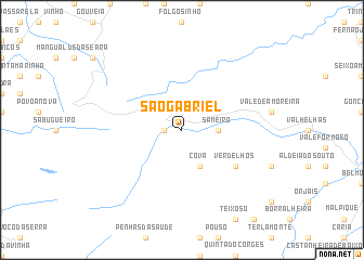
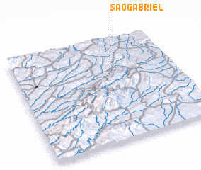
São Gabriel (Guarda, Portugal)São Gabriel is a town in the Guarda region of Portugal. An overview map of the region around São Gabriel is displayed below.
regional and 3d topo map of São Gabriel, Portugal ::
São Gabriel airports ::
The nearest airport is VRL - Vila Real, located 98.6 km north of São Gabriel.
Other airports nearby include OPO - Porto (136.1 km north west), BGC - Braganca (175.6 km north), BJZ - Badajoz Talavera La Real (177.8 km south), VGO - Vigo (223.7 km north west), Nearby towns ::
 Places with similar names to São Gabriel, Portugal ::
// São Gabriel (BR)
// São Gabriel (BR)
// São Gabriel (BR)
// São Gabriel (BR)
// São Gabriel (BR)
// São Gabriel (PT)
// Sakabariley (GN)
Disclaimer :: Information on this page comes without warranty of any kind |
||
|
Where is São Gabriel? Elevation and coordinates ::
Latitude (lat): 40°24'0"N Longitude (lon): 7°31'0"W
Elevation (approx.): 662m (map arrows pan, magnifying glasses zoom) |
||
|
Visiting São Gabriel? Hotel/Accommodation ::
Book a hotel in São Gabriel Travel Guide ::
Buy a travel guide for Portugal rental cars ::
car rental offers GPS waypoint ::
download a GPX waypoint (PoI) of São Gabriel for your GPS receiver
|
||