|
search place name
|
||
São Simão de Litém (Leiria, Portugal)São Simão de Litém is a town in the Leiria region of Portugal. An overview map of the region around São Simão de Litém is displayed below.
regional and 3d topo map of São Simão de Litém, Portugal ::

São Simão de Litém airports ::
The nearest airport is LIS - Lisbon Lisboa, located 56.1 km south west of São Simão de Litém.
Other airports nearby include BJZ - Badajoz Talavera La Real (157.0 km east), Nearby towns ::
Casal das Donas (2.3km north east) //
Casal Sarrão (3.7km south) //
Raposa (3.4km north east) //
Glória (4.7km south west) //
Casal da Caneira (4.7km south east) //
Malhada dos Porcos (4.7km north west) //
Casalinho (5.7km north east) //
Azerveira (6.0km east) //
Quinta de Santa Marta (7.0km north west) //
Monte da Várzea (6.8km north east) //
Cortiçois (8.0km north west) //
Bemfica (8.0km north west) //
Azeitada (8.6km north west) //
Arneiro da Azinheira (9.4km south west) //
Paços Negros (9.4km north east) //
[all distances 'as the bird flies' and approximate] 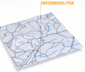 Places with similar names to São Simão de Litém, Portugal :: Disclaimer :: Information on this page comes without warranty of any kind |
||
|
Where is São Simão de Litém? Elevation and coordinates ::
Latitude (lat): 39°5'0"N Longitude (lon): 8°37'0"W
Elevation (approx.): 49m (map arrows pan, magnifying glasses zoom) |
||
|
Visiting São Simão de Litém? Hotel/Accommodation ::
Book a hotel in São Simão de Litém Travel Guide ::
Buy a travel guide for Portugal rental cars ::
car rental offers GPS waypoint ::
download a GPX waypoint (PoI) of São Simão de Litém for your GPS receiver
|
||