|
search place name
|
||
Ban Al Tae Tae (Narathiwat, Thailand)Ban Al Tae Tae is a town in the Narathiwat region of Thailand. An overview map of the region around Ban Al Tae Tae is displayed below.
regional and 3d topo map of Ban Al Tae Tae, Thailand ::

Ban Al Tae Tae airports ::
The nearest airport is NAW - Narathiwat, located 46.4 km north east of Ban Al Tae Tae.
Other airports nearby include PAN - Pattani (73.8 km north west), KBR - Kota Bahru Sultan Ismail Petra (90.8 km east), AOR - Alor Setar Sultan Abdul Halim (119.0 km west), HDY - Songkhla Hat Yai Intl (144.4 km north west), Nearby towns ::
Ban Ka Yo Ma Ti (3.5km north east) //
Ban Ka Long (4.2km north west) //
Si Sakhon (4.5km north east) //
Kampong Kalubi (4.8km east) //
Kampong Rayao Mati (6.1km north east) //
Ban Pa Phai (6.3km north west) //
Ban Al Chu Cho (7.0km south) //
Ban Ai Tui (7.0km east) //
Ban Suan Phlu (7.2km north) //
Ban Hat Sai (7.2km north west) //
Ban Tham Nop (8.1km north) //
Ban La O (9.8km south east) //
Si Sakhon (10.1km south east) //
[all distances 'as the bird flies' and approximate] 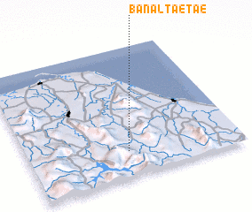 Places with similar names to Ban Al Tae Tae, Thailand :: Disclaimer :: Information on this page comes without warranty of any kind |
||
|
Where is Ban Al Tae Tae? Elevation and coordinates ::
Latitude (lat): 6°11'59"N Longitude (lon): 101°28'23"E
Elevation (approx.): 54m (map arrows pan, magnifying glasses zoom) |
||
|
Visiting Ban Al Tae Tae? Hotel/Accommodation ::
Book a hotel in Ban Al Tae Tae Travel Guide ::
Buy a travel guide for Thailand rental cars ::
car rental offers GPS waypoint ::
download a GPX waypoint (PoI) of Ban Al Tae Tae for your GPS receiver
|
||