|
search place name
|
||
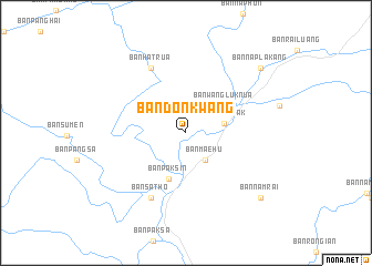
Ban Don Kwang (Sukhothai, Thailand)Ban Don Kwang is a town in the Sukhothai region of Thailand. An overview map of the region around Ban Don Kwang is displayed below.
regional and 3d topo map of Ban Don Kwang, Thailand ::
Ban Don Kwang airports ::
The nearest airport is LPT - Lampang, located 64.4 km north of Ban Don Kwang.
Other airports nearby include PRH - Phrae (65.6 km north east), PHS - Phitsanulok (120.3 km south east), Nearby towns ::
Ban Mae Hu (3.4km south east) //
Ban Pang Sak (3.8km east) //
Ban Wang Luk Nua (4.6km north east) //
Ban Pak Sin (4.9km south) //
Ban Hat Rua (7.3km north west) //
Ban Satho (7.3km south west) //
Ban Na Pla Kang (9.7km north east) //
Ban Nam Rai (9.7km south east) //
[all distances 'as the bird flies' and approximate] 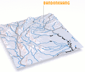 Places with similar names to Ban Don Kwang, Thailand ::
// Ban Don Khwang (TH)
// Ban Don Khwang (TH)
// Ban Don Khwang (TH)
// Ban Don Khwang (TH)
// Ban Ton Khwang (TH)
Disclaimer :: Information on this page comes without warranty of any kind |
||
|
Where is Ban Don Kwang? Elevation and coordinates ::
Latitude (lat): 17°43'30"N Longitude (lon): 99°42'55"E
Elevation (approx.): 93m (map arrows pan, magnifying glasses zoom) |
||
|
Visiting Ban Don Kwang? Hotel/Accommodation ::
Book a hotel in Ban Don Kwang Travel Guide ::
Buy a travel guide for Thailand rental cars ::
car rental offers GPS waypoint ::
download a GPX waypoint (PoI) of Ban Don Kwang for your GPS receiver
|
||