|
search place name
|
||
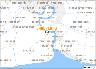
Bang Pla Kot (Samut Prakan, Thailand)Bang Pla Kot is a town in the Samut Prakan region of Thailand. An overview map of the region around Bang Pla Kot is displayed below.
regional and 3d topo map of Bang Pla Kot, Thailand ::
Bang Pla Kot airports ::
The nearest airport is BKK - Bangkok Intl, located 34.9 km north of Bang Pla Kot.
Other airports nearby include UTP - Rayong U Taphao Intl (112.3 km south east), HHQ - Prachuap Khiri Khan Hua Hin (125.8 km south west), NAK - Nakhon Ratchasima Khorat (220.0 km north east), MGZ - Myeik (247.0 km south west), Nearby towns ::
Ban Pak Khlong Tha Kwian (1.9km north) //
Ban Song Phi Nong (1.9km north) //
Ban Bang Prong (1.9km north) //
Bang Nang Kreng (2.6km north east) //
Ban Bang Yai (2.6km north east) //
Ban Khlong Bang Duan (2.6km north east) //
Ban Thanon Tat Mai (2.6km south east) //
Ban Bang Chak (2.6km north west) //
Ban Khung Bang Ping (2.6km south west) //
Ban Rai Oi (2.6km north west) //
Ban Ko Loi (2.6km south west) //
Samut Prakan (3.6km east) //
Ban Khlong Suan (3.7km south) //
Ban Khlong Sanphasamit (3.7km south) //
Ban Pak Khlong Sanphasamit (4.1km south east) //
Ban Khlong Hua Sakae (4.1km north east) //
Ban Thai Ban (4.1km south east) //
Ban Khlong Ta Khet (4.1km south east) //
Ban Khlong Phra Ram (4.1km south west) //
Ban Khru Nok (5.2km north west) //
Ban Khlong Bang Ping (5.4km east) //
Ban Kong Din (5.6km south) //
Ban Laem Fa Pha (5.6km south) //
Ban Khlong Khut (5.6km south) //
Ban Thong Khung (5.6km north) //
Ban Khlong Nang Li (5.6km north) //
Ban Khlong Saen Suk (5.8km south) //
Samrong (5.8km north) //
Ban Pratu Nam Bang Ping (5.7km east) //
[all distances 'as the bird flies' and approximate]  Places with similar names to Bang Pla Kot, Thailand :: Disclaimer :: Information on this page comes without warranty of any kind |
||
|
Where is Bang Pla Kot? Elevation and coordinates ::
Latitude (lat): 13°36'0"N Longitude (lon): 100°34'0"E
Elevation (approx.): 3m (map arrows pan, magnifying glasses zoom) |
||
|
Visiting Bang Pla Kot? Hotel/Accommodation ::
Book a hotel in Bang Pla Kot Travel Guide ::
Buy a travel guide for Thailand rental cars ::
car rental offers GPS waypoint ::
download a GPX waypoint (PoI) of Bang Pla Kot for your GPS receiver
|
||