|
search place name
|
||
Ban Huai Chan (Chaiyaphum, Thailand)Ban Huai Chan is a town in the Chaiyaphum region of Thailand. An overview map of the region around Ban Huai Chan is displayed below.
regional and 3d topo map of Ban Huai Chan, Thailand ::

Ban Huai Chan airports ::
The nearest airport is NAK - Nakhon Ratchasima Khorat, located 110.6 km south of Ban Huai Chan.
Other airports nearby include LOE - Loei (169.9 km north), UTH - Udon Thani (179.8 km north east), PHS - Phitsanulok (209.7 km north west), Nearby towns ::
Ban Na Fai (1.9km south) //
Ban Tat Ton (1) (1.9km north) //
Ban Na Si Nuan (1.8km east) //
Ban Khro (2.6km north west) //
Ban Nong Ya Plong (3.6km west) //
Ban Na Kai Sao (4.1km south east) //
Ban Nong Waeng Noi (5.6km south) //
Ban Rai Ya Plong (5.5km west) //
Ban Sieo Noi (5.8km south) //
Ban Kut Khamin (6.6km south west) //
Ban That Kong Khao Bang (6.5km south west) //
Ban Cho Raka (7.6km south) //
Ban Muang (7.6km south) //
Ban Pho Yai (7.6km south) //
Ban Na Wang (7.4km east) //
Ban Sieo (8.2km south east) //
Ban Kut Hin (10.3km south east) //
[all distances 'as the bird flies' and approximate] 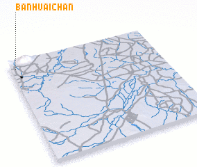 Places with similar names to Ban Huai Chan, Thailand ::
// Ban Huai Chan (TH)
// Ban Huai Chang Hai (TH)
// Ban Huai Chun (TH)
// Ban Huai Chun (TH)
// Ban Huai I Chin (TH)
// Ban Huai I Chin (TH)
// Ban Houaychan (LA)
// Ban Houaychèn (LA)
// Ban Houaychin (LA)
// Ban Houaychon (LA)
Disclaimer :: Information on this page comes without warranty of any kind |
||
|
Where is Ban Huai Chan? Elevation and coordinates ::
Latitude (lat): 15°56'0"N Longitude (lon): 102°2'0"E
Elevation (approx.): 194m (map arrows pan, magnifying glasses zoom) |
||
|
Visiting Ban Huai Chan? Hotel/Accommodation ::
Book a hotel in Ban Huai Chan Travel Guide ::
Buy a travel guide for Thailand rental cars ::
car rental offers GPS waypoint ::
download a GPX waypoint (PoI) of Ban Huai Chan for your GPS receiver
|
||