|
search place name
|
||
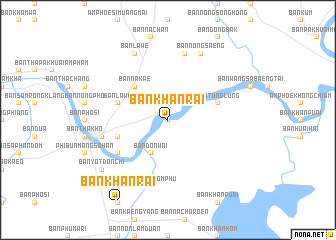
Ban Khan Rai (Ubon Ratchathani, Thailand)Ban Khan Rai is a town in the Ubon Ratchathani region of Thailand. An overview map of the region around Ban Khan Rai is displayed below.
regional and 3d topo map of Ban Khan Rai, Thailand ::
Ban Khan Rai airports ::
The nearest airport is PKZ - Pakse, located 52.1 km east of Ban Khan Rai.
Other airports nearby include ZVK - Savannakhet (154.7 km north), SNO - Sakon Nakhon (248.9 km north west), REP - Siem-reap Siem Reap (261.7 km south west), Nearby towns ::
Ban Hua Don (0.0km north) //
Ban Tha Sieo (2.6km north east) //
Ban Khan Lum (4.0km north east) //
Ban Don Wai (4.1km south west) //
Ban Na Kae (5.2km north west) //
Ban Lawe (5.7km west) //
Ban Lat Wari (5.7km east) //
Ban Na Chan (5.7km west) //
Ban Tunglung (5.7km east) //
Ban Saphu Tai (5.7km west) //
Ban Kaeng Charoen (6.5km south west) //
Ban Kham Phan (7.6km north) //
Ban Saphu (7.4km west) //
Ban Kut Chomphu (7.6km south) //
Ban Nong Saeng (8.2km north east) //
Ban Lawe (8.2km north west) //
Ban Yot Don Chi (9.1km south west) //
[all distances 'as the bird flies' and approximate]  Places with similar names to Ban Khan Rai, Thailand ::
// Ban Khan Rai (TH)
// Ban Khuan Rae (TH)
Disclaimer :: Information on this page comes without warranty of any kind |
||
|
Where is Ban Khan Rai? Elevation and coordinates ::
Latitude (lat): 15°16'0"N Longitude (lon): 105°19'0"E
Elevation (approx.): 113m (map arrows pan, magnifying glasses zoom) |
||
|
Visiting Ban Khan Rai? Hotel/Accommodation ::
Book a hotel in Ban Khan Rai Travel Guide ::
Buy a travel guide for Thailand rental cars ::
car rental offers GPS waypoint ::
download a GPX waypoint (PoI) of Ban Khan Rai for your GPS receiver
|
||