|
search place name
|
||
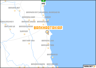
Ban Khao Takiap (Prachuap Khiri Khan, Thailand)Ban Khao Takiap is a town in the Prachuap Khiri Khan region of Thailand. An overview map of the region around Ban Khao Takiap is displayed below.
regional and 3d topo map of Ban Khao Takiap, Thailand ::
Ban Khao Takiap airports ::
The nearest airport is HHQ - Prachuap Khiri Khan Hua Hin, located 13.3 km north of Ban Khao Takiap.
Other airports nearby include UTP - Rayong U Taphao Intl (114.3 km east), MGZ - Myeik (146.5 km west), BKK - Bangkok Intl (169.3 km north east), Nearby towns ::
Ban Hua Don (0.0km north) //
Ban Nong Chik (3.7km south) //
Ban Nong Kae (4.1km north west) //
Hua Hin (5.6km north) //
Ban Khao Tao (1) (5.6km south) //
Ban Thung Iung (5.8km north) //
Ban Phra Ratchawang Klai Kangwon (1) (7.6km north) //
Ban Nong Bua (7.5km west) //
Ban Nong Phran Phuk (7.5km west) //
Ban Nong Kham (7.8km north west) //
Ban Nong Sadao (8.1km north west) //
Ban Thap Tai (1) (8.1km south west) //
Ban Nong Khon (9.1km north west) //
[all distances 'as the bird flies' and approximate] 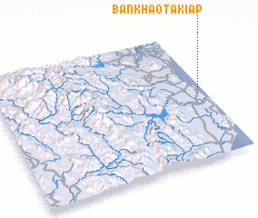 Places with similar names to Ban Khao Takiap, Thailand :: Disclaimer :: Information on this page comes without warranty of any kind |
||
|
Where is Ban Khao Takiap? Elevation and coordinates ::
Latitude (lat): 12°31'0"N Longitude (lon): 99°58'0"E
Elevation (approx.): 22m (map arrows pan, magnifying glasses zoom) |
||
|
Visiting Ban Khao Takiap? Hotel/Accommodation ::
Book a hotel in Ban Khao Takiap Travel Guide ::
Buy a travel guide for Thailand rental cars ::
car rental offers GPS waypoint ::
download a GPX waypoint (PoI) of Ban Khao Takiap for your GPS receiver
|
||