|
search place name
|
||
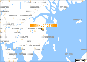
Ban Khlong Thom (Phangnga, Thailand)Ban Khlong Thom is a town in the Phangnga region of Thailand. An overview map of the region around Ban Khlong Thom is displayed below.
regional and 3d topo map of Ban Khlong Thom, Thailand ::
Ban Khlong Thom airports ::
The nearest airport is HKT - Phuket Intl, located 21.1 km south west of Ban Khlong Thom.
Other airports nearby include TST - Trang (152.5 km south east), NST - Nakhon Si Thammarat Cha Ian (167.6 km east), LGK - Pulau Langkawi Intl (255.0 km south east), HDY - Songkhla Hat Yai Intl (259.2 km south east), Nearby towns ::
Ban Met Nang Chi (1.9km south) //
Ban Thung (2.6km north west) //
Ban Ao Makham (3.7km south) //
Ban Chong Khap (3.7km west) //
Ban Phra At Thao (4.1km south east) //
Ban Bang Lam (5.5km west) //
Ban Khlong Sai (5.9km south) //
Ban Hat Sai Pluak Hoi (5.9km south) //
Ban Bang Son (7.6km west) //
Ban Ti Te (7.8km south west) //
Ban Tha Khuan (8.3km south west) //
Ban Kalai (9.2km north west) //
Ban Chiang Mai (9.2km north west) //
Ban Mai (9.2km south west) //
[all distances 'as the bird flies' and approximate]  Places with similar names to Ban Khlong Thom, Thailand ::
// Ban Khlong Thom (TH)
Disclaimer :: Information on this page comes without warranty of any kind |
||
|
Where is Ban Khlong Thom? Elevation and coordinates ::
Latitude (lat): 8°15'0"N Longitude (lon): 98°27'0"E
Elevation (approx.): 9m (map arrows pan, magnifying glasses zoom) |
||
|
Visiting Ban Khlong Thom? Hotel/Accommodation ::
Book a hotel in Ban Khlong Thom Travel Guide ::
Buy a travel guide for Thailand rental cars ::
car rental offers GPS waypoint ::
download a GPX waypoint (PoI) of Ban Khlong Thom for your GPS receiver
|
||