|
search place name
|
||
Ban Ko Rong (Ubon Ratchathani, Thailand)Ban Ko Rong is a town in the Ubon Ratchathani region of Thailand. An overview map of the region around Ban Ko Rong is displayed below.
regional and 3d topo map of Ban Ko Rong, Thailand ::

Ban Ko Rong airports ::
The nearest airport is PKZ - Pakse, located 83.1 km south east of Ban Ko Rong.
Other airports nearby include ZVK - Savannakhet (108.9 km north west), SNO - Sakon Nakhon (206.8 km north west), Nearby towns ::
Ban Pong (2.6km north east) //
Ban Katiat (2.6km north west) //
Ban Samrong (3.7km south) //
Ban Song Khon (5.8km north) //
Ban Sang Kung (5.8km north) //
Ban Khan Soum Soa (7.4km east) //
Ban Chiang (7.7km north west) //
Ban Mak Keua (8.2km north east) //
Ban Pak Huai Muang (8.0km south east) //
Ban Kham Mani (8.0km north west) //
Ban Na Kham (9.1km south east) //
[all distances 'as the bird flies' and approximate] 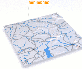 Places with similar names to Ban Ko Rong, Thailand ::
// Benquerença (PT)
// Ban Kariang (TH)
// Ban Kariang (TH)
// Ban Kariang (TH)
// Ban Kariang (TH)
// Ban Kariang (TH)
// Ban Khrang (TH)
// Ban Khru Nok (TH)
// Ban Ko Rang (TH)
// Ban Kraeng (TH)
Disclaimer :: Information on this page comes without warranty of any kind |
||
|
Where is Ban Ko Rong? Elevation and coordinates ::
Latitude (lat): 15°46'0"N Longitude (lon): 105°22'0"E
Elevation (approx.): 141m (map arrows pan, magnifying glasses zoom) |
||
|
Visiting Ban Ko Rong? Hotel/Accommodation ::
Book a hotel in Ban Ko Rong Travel Guide ::
Buy a travel guide for Thailand rental cars ::
car rental offers GPS waypoint ::
download a GPX waypoint (PoI) of Ban Ko Rong for your GPS receiver
|
||