|
search place name
|
||
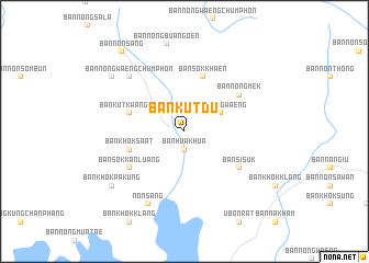
Ban Kut Du (Udon Thani, Thailand)Ban Kut Du is a town in the Udon Thani region of Thailand. An overview map of the region around Ban Kut Du is displayed below.
regional and 3d topo map of Ban Kut Du, Thailand ::
Ban Kut Du airports ::
The nearest airport is UTH - Udon Thani, located 54.0 km north of Ban Kut Du.
Other airports nearby include LOE - Loei (108.9 km north west), VTE - Vientiane Wattay Intl (116.8 km north), SNO - Sakon Nakhon (164.2 km east), NAK - Nakhon Ratchasima Khorat (228.1 km south), Nearby towns ::
Ban Hua Khua (1.9km south) //
Ban Nong Waeng (4.0km north east) //
Ban Khok Sa-at (5.6km west) //
Ban Kut Kwang Soi (5.6km west) //
Ban Sok Khaen (5.8km north) //
Ban Sok Kan Luang (6.5km south west) //
Ban Si Suk (6.5km south east) //
Ban Nong Mek (6.5km north east) //
Ban Khok Phak Hom (7.7km north west) //
Ban Nong Waeng Chumphon (7.7km north west) //
Non Sang (8.2km south west) //
Ban Nong Bua Ngoen (9.1km north) //
Ban Nong Lao Khao (9.0km north west) //
Ban Khok Pa Kung (9.0km south west) //
Ban Non Sang (10.2km north west) //
[all distances 'as the bird flies' and approximate]  Places with similar names to Ban Kut Du, Thailand ::
// Bongtud (PH)
// Bungtod (PH)
// Ban Kadat (TH)
// Ban Kot Du (TH)
// Ban Kadat (LA)
// Ban Kadôt (LA)
// Ban Kèotat (LA)
Disclaimer :: Information on this page comes without warranty of any kind |
||
|
Where is Ban Kut Du? Elevation and coordinates ::
Latitude (lat): 16°56'0"N Longitude (lon): 102°36'0"E
Elevation (approx.): 188m (map arrows pan, magnifying glasses zoom) |
||
|
Visiting Ban Kut Du? Hotel/Accommodation ::
Book a hotel in Ban Kut Du Travel Guide ::
Buy a travel guide for Thailand rental cars ::
car rental offers GPS waypoint ::
download a GPX waypoint (PoI) of Ban Kut Du for your GPS receiver
|
||