|
search place name
|
||
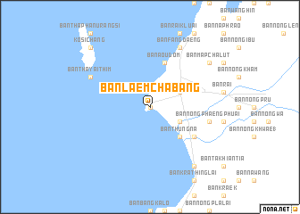
Ban Laem Chabang (Chon Buri, Thailand)Ban Laem Chabang is a town in the Chon Buri region of Thailand. An overview map of the region around Ban Laem Chabang is displayed below.
regional and 3d topo map of Ban Laem Chabang, Thailand ::
Ban Laem Chabang airports ::
The nearest airport is UTP - Rayong U Taphao Intl, located 46.5 km south of Ban Laem Chabang.
Other airports nearby include BKK - Bangkok Intl (96.5 km north), HHQ - Prachuap Khiri Khan Hua Hin (112.6 km south west), NAK - Nakhon Ratchasima Khorat (242.1 km north east), Nearby towns ::
Ban Ko Klang (0.0km north) //
Ban Na (4.1km south east) //
Ban Noen Phai (4.1km south east) //
Ban Thung Sukla (1) (4.1km north east) //
Ban Thung Na (5.2km south east) //
Ban Ao Udom (5.8km north) //
Ban Bang Lamung (6.6km south east) //
Ban Thung Krat (6.6km south east) //
Ban Nong Phaeng Phuai (7.5km east) //
Ban Tha Yai Thim (8.1km north west) //
Ban Fang Daeng (8.2km north east) //
Ban Rong Po (9.2km south east) //
Ban Map Chalut (9.1km north east) //
Ban Tha Thewawong (10.3km north west) //
Ko Si Chang (10.3km north west) //
[all distances 'as the bird flies' and approximate] 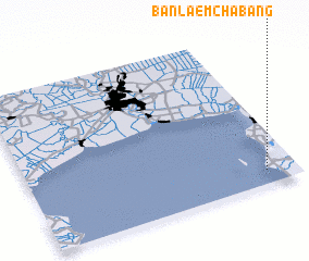 Places with similar names to Ban Laem Chabang, Thailand :: Disclaimer :: Information on this page comes without warranty of any kind |
||
|
Where is Ban Laem Chabang? Elevation and coordinates ::
Latitude (lat): 13°5'0"N Longitude (lon): 100°53'0"E
Elevation (approx.): 4m (map arrows pan, magnifying glasses zoom) |
||
|
Visiting Ban Laem Chabang? Hotel/Accommodation ::
Book a hotel in Ban Laem Chabang Travel Guide ::
Buy a travel guide for Thailand rental cars ::
car rental offers GPS waypoint ::
download a GPX waypoint (PoI) of Ban Laem Chabang for your GPS receiver
|
||