|
search place name
|
||
Ban Mae Kho (Mae Hong Son, Thailand)Ban Mae Kho is a town in the Mae Hong Son region of Thailand. An overview map of the region around Ban Mae Kho is displayed below.
regional and 3d topo map of Ban Mae Kho, Thailand ::

Ban Mae Kho airports ::
The nearest airport is LPT - Lampang, located 179.2 km east of Ban Mae Kho.
Other airports nearby include MOG - Mong Hsat (256.1 km north east), RGN - Yangon Intl (263.3 km south west), Nearby towns ::
Ban Mae Ki (2.4km north) //
Ban Huai Pong Lao (2.9km south east) //
Ban Pa Piang Luang (5.3km north) //
Ban Huai Pu (5.7km south) //
Ban Huai Khlong Se (5.9km north east) //
Ban Huai San (7.0km north) //
Ban Thung Wang Kwang (7.1km south east) //
Ban Phatho (7.4km north west) //
Ban Khun Mae Su (7.7km south) //
Ban Phakae (8.3km north west) //
Ban Huai Khan (8.4km north east) //
Ban Tha Hin Som (9.1km north east) //
Ban Hang Pon (11.1km north east) //
[all distances 'as the bird flies' and approximate] 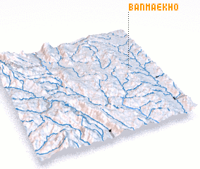 Places with similar names to Ban Mae Kho, Thailand ::
// Ban Mae Khao (TH)
// Ban Mae Khao (TH)
// Ban Mae Khi (TH)
// Ban Mae Khi (TH)
// Ban Mae Khi (TH)
// Ban Mae Kho (TH)
// Ban Maeo Khao (TH)
// Ban Mae Ok Hu (TH)
// Ban Mai Khao (TH)
// Ban Ma Kha (TH)
Disclaimer :: Information on this page comes without warranty of any kind |
||
|
Where is Ban Mae Kho? Elevation and coordinates ::
Latitude (lat): 18°37'35"N Longitude (lon): 97°50'57"E
Elevation (approx.): 472m (map arrows pan, magnifying glasses zoom) |
||
|
Visiting Ban Mae Kho? Hotel/Accommodation ::
Book a hotel in Ban Mae Kho Travel Guide ::
Buy a travel guide for Thailand rental cars ::
car rental offers GPS waypoint ::
download a GPX waypoint (PoI) of Ban Mae Kho for your GPS receiver
|
||